Photos, Patagonia.

Photos, from two and a half months ago, on a different continent, the other hemisphere. Photos from winter while now in Maryland it’s summertime, but morning dew is still a thing. This photoset uploaded from home, where it’s nice to be back working farmers market routines, back to a different kind of relentless activity. Right now is the intermission before life back in California. But that’s now, and this is back then.


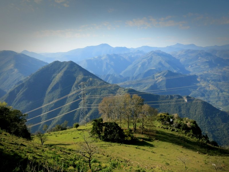
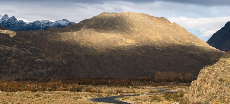
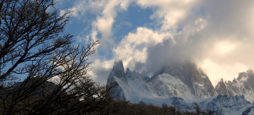
Photos. We leave the Carretera Austral via Paso Roballos, heading back to Argentina from Chile. See the fringe of snow on the mountaintops? We stay huddled in our sleeping bags all night long, and nights were long. It’s either Autumn or Winter, whichever, doesn’t matter, either way it’s late enough so far south that the dusk-time light stretches on and on, propelled by a sun that can’t quite hit the peak of the sky anymore. The dirt road over the pass deposits us onto Argentinean pampa, see the shrub bush by the roadside. Take the dirt until it ends and intersects Ruta 40. Follow paved highway lines into the sunset. Continue reading

Report from Patagonia.

Patagonia, April/May 2015.

IMG_0933

Autumn time, the trees are those colors reminiscent of home in fall, or months and a year ago in Colorado. Walking, leaves scrunch underfoot, each step pushing down into the dirt tattered pieces of that carpet. The sun crests low in the sky each day. Breakfast generally happens once it’s light enough out that surely the sun must be up, but we’ll sit outside by the stove warming coffee and it’ll still be an hour before sunlight actually reaches and warms us. Paul pronounced a few weeks ago, “There’ll be a time when the sun comes out but it’s not actually warm.” We’re not there yet, but we’re getting close.

IMG_0040

Continue reading

Chile 1. To Argentina, via Paso Vergara.

There was a brief stint of riding in northern Chile. Then there was a jump ahead to go spend the holidays with a friend from home and her family. It’s been a while on the road, and the end looms near. Being able to spend time welcomed and treated as part of a family, incredible. Thank you.

We have alternative extended families in other cyclists, effectively. The cyclist network connects more or less all of us now. So many of us are looking at calendars and it’s been 1 year, 2 years, maybe more that we’ve been on the road. Slowly we meet each other, slowly word gets passed around of who else is nearby or rode through in the past few months. Slowly the network grows. By the time we get to central Chile and Argentina, we all know each other one way or another.

Continue reading

Southern Hemisphere life. Ecuador 1.

imageEquator crossing achieved, few days south of the Ecuador-Colombian border. It’s hard to miss, going south along the Panamerican highway just look for the giant orange pole sticking out of the ground. Since entering Ecuador, rode out on the first stretch of non-highway routes south to Tumbaco and the Casa de Ciclistas at Santiago’s house, just outside of Quito. One night of food poisoning en route, and the rest of the last week has been resting, recovering, cleaning everything.

image
Continue reading

Colombia, 2: Medellin to Bogotá.

Medellin to Bogotá, via La Ceja, Sonsón, Nariño, Aguas Termales de Espiritu Santo, Florencia, La Dorado.

Into the Cordillera Central. Geographically, Medellin is a sprawling valley trap. You climb to get there, you climb to leave. Better start getting used to the 1000m ascents. Lowest gear spinning gives you plenty of time to appreciate the sky (it’s getting closer!) and work on your Spanish proverb practice. Once in the mountains themselves, settlements become farther apart. Small farms- fincas- dominate the landscape, herding cattle or growing fruits and vegetables. The latter get washed right next to the road, wherever a small stream comes out of the mountainside, then packed into burlap sacks. The farmers are universally friendly, waving or shouting encouragement or inviting you in for aqua de panela, hot sugar cane juice, they claim it’s the secret to the Colombian cyclists’ success. Colombians took 1st and 2nd in the Giro d’Italia this year, did you know? I love this country.

image

Continue reading

Colombia photos, 1.

Off the boat at Turbo and rolling. No waiting around, this is the start of South America, continent #2, chapter 3. The Andes are calling mountain promise, but first a few more days biking across banana tree flatlands. Then up over the first cordillera branch to Medellin and the Casa de Ciclistas there. Meet 7 other traveling cyclists resting there. 4 of us leave together, but the other 3 headed straight for Ecuador, me to Bogotá. More on that next. Here the first set of photos from this fantastic country.

image

image

image

image

Continue reading

Nicaragua

imageThe last segment with Sebastiaan. We leave Honduras, reputably the most dangerous country in Central America, for Nicaragua, reputedly the safest. Yet in Honduras we were overwhelmingly welcomed into peoples’ homes, and 10km into Nicaragua a teenager spat at my shirt, which probably only helped clean the sweat and salt encrusted thing. Safety is funny sometimes.

imageWe crossed the border at Las Manos, at the peak of the mountain pass. Either there or the last few days in Honduras we crossed over the Continental Divide, returning to the Pacific. The Divide is easily noticeable throughout Central America as the Caribbean side is characterized by hot and humid weather, and the Pacific side lies hot and dry. Parched, especially now, since we’re coming through in the hottest part of the year, just before the start of the rainy season.

image Beating the heat.

image First stop in Nicaragua: Somoto, just across the border. Resting a few days there, reading and watching football and taking a hike through the canyon.

image Following the track down to the river.

image To walk a bit, then cool off in the water and float downriver a ways. The current strong enough to pull us along, weak enough to be able to just sit back and relax.

image Sheer walls, rocky bluffs.

image Back on the road, aiming to beat the heat by heading back into the mountains. We’ve been avoiding as much as possible the Pan American highway, the main traffic route through Central and South America that stretches all the way down into Peru and Bolivia from Mexico, with only a few interruptions. After riding the PanAm for 40 miles from Somoto, we turned onto the stone-paved road to Jinotega, coffee country.

image A quiet road, past farms and not much else. All would have been well, except both Sebastiaan and I started getting flat tires, and since Honduras our tube patches have not been holding up. Maybe we each had a bad batch of glue, or bad patches, but we would fix a puncture only to roll out and flat a few minutes later, when the puncture invariably blew a hole in the side of the patch. Patching over the patches inevitably just wasted patches. Replacing the punctured tube with a new tube was the best strategy, until we ran out of spare tubes. In any town down here though, it’s always possible to find 26″ inner tubes, so as long as we could limp to the next town, we could keep moving forward. Sebastian was riding on 700c tires, and while most small towns won’t have that sized tubes, it’s possible to fit in a 26″ inner tube, carefully, despite the larger sized wheel. Rubber stretches.
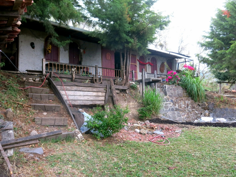
image But up we went, to the permaculture retreat of La Biosfera. Suzanne welcomes in traveling cyclists, so we spent a few days there, resting and recuperating from a bout of intestinal parasites.

image Parasite symptoms include: stomach cramping, nausea, diarrhea, some combination of the above. Parasite medicine costs: $3US for the name brand meds, $1US for the generic ones. Espresso costs $1-2US. From bad water or food, parasites have been explained to us as a routine matter since Guatemala, with most people saying they just get the test done once a year and take the corresponding medicine to knock out the little buggers.

image Parasites cured, our final days riding together took us to Granada, the first city the Spaniards founded in the Americas. Beautifully colonial, and in the summer heat all foot traffic gravitates to whichever side of the street offers some shade from the surrounding buildings.

image Not even the heat can stop a baseball game, either the children playing or the old men standing about watching.

image Many sports going on; the city was built on the shores of Lake Nicaragua, and was being used as the arena for the Paddle Board World Championships.

image City built from stone, swathed in colors.

image Also, more bug problems. This round: bedbugs! They bite, they itch, and there’s no easy medicine. One pharmacy suggested smoking ourselves. We didn’t know what that meant. A few days of riding and sweating under the sun seems to have cured them now.

image And then our final goodbye. Time for me to continue to Costa Rica to meet some friends, and Sebastiaan to start returning to Mexico to catch a flight home in a few weeks. A great riding buddy, sad to say goodbye.

image Sebastiaan, between Granada and the border you missed out on some wind, windmills, and volcano views. Safe travels man.
Mexico City; DF

A rest, here, for 5 days, the first actual rest in Mexico. Anonymity in the enormous city, in the hostel too, Ace hides in a safe place on the roof so to everyone else at the hostel I’m just some scraggly bearded American wearing the same clothes over and over. Which we’re all doing but rain pants and a cycling cap, what’s with that bro?

image

I’m here with Daniel, below, who biked across the US last year and just graduated from Ohio State, moving to Sacramento soon to start working with AmeriCorps. Thanks for coming to visit!
image

We spend the days touring the city, eating, playing cards. This city is epic, so much character, so much to do. We stayed in the city center by the Zocalo, the central plaza.

image
Coyoacan lies south of the city center. It’s a beautiful colonial center, where Cortes originally built his home until problems with the Aztecs forced him to move back to their part of the city. There are big indoor markets here, street artists outside, cobblestones and elaborate churches. Also apparently an extremely popular coffee shop, just look for the place where everyone -everyone- is walking away from with a take-out cup decorated in the red, white, and green of the Mexican flag. Frida Kahlo’s home, the Blue House, it too is in Coyoacan as well. The house is a kind of contradiction, vibrantly painted, visually beautiful, but the artwork and the history of Frida inside bears witness to the pain and struggle of her life.

image
Coyoacan, colonial, elegant.

image
Then there’s Xochimilco, south-southwest of the center. The area is full of canals, upon which people rent long, flat boats and are paddled around for an hour or two or three, perfect for a little fiesta on the water. Mariachi bands and food vendors float around on boats of their own, entertaining, feeding.

image
Festive.

image
And a day tour to Puebla, a colonial city to the west of the city famed for its churches. Here, the Chapel of the Rosario, was deemed the eighth wonder of the Old World when completed in the 17th century, due to its ornateness. Every surface inside covered with gold gilding, unbelievable.
image
Old World charm in the New World.

image
More, on top of the world, the view from the Pyramid of Cholula, third largest pyramid in the world. Although the Spanish built a church on top of the pyramid, and now the pyramid itself is a tad overgrown with grass and trees, so from many angles tends to resemble a large hill.

image
Other pyramids, in Teotihuacan. We stand atop the Pyramid of the Moon, the Pyramid of the Sun in the background left. Pyramid of the Sun = 7th largest pyramid in the world.

image
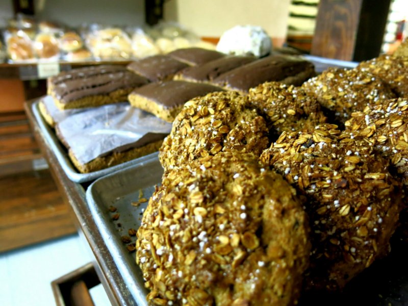
Not to be missed, anywhere in Mexico, are the panaderias. All of these bakeries, phenomenal! Variety in opulence, from sugar-cookies to the Mexican conchas, those balls of soft enriched dough with a hardened sugar coating resembling a sea-shell, to cake “popsicles”, to whole wheat biscuits with a light chocolate coating. We did our due diligence tasting as many as we could…

image
Yes please…

image
Save room for dessert… Or maybe midday snack?

image
Some of the best whole wheat pastries ever. So filling, and so tasty. Those rectangles in the background? Perfect for soon-to-be-less-hungry cyclists.

image
Also, our favorite quesadilla stand in the city. Figuring out the Mexican eating times has taken a little while. Many street food stands are open starting late morning until the evening, but promptly close at 5 or 6. The Mexicans favor a more substantial lunch and a (much later) lighter dinner, not exactly the American schedule.

image
Eating well in Mexico, check.

image
But not everything is fun and games and food. A week or two ago some leaf-cutter ants visited me and the tent one night. Apparently they have a taste for tent mesh, so the inner layer of my tent now has quite a few holes and tears. A morning spent sewing up the worst offenses, productive, though now portions of the mesh look like there are giant spiders crawling up the sides. Quite a sight to wake go to. But so far it’s still usable, so that’s that.

Photos; Northeast Mexico

From the border to the metropolis. Tamaulipas to San Luis Potosi to Hidalgo to El Estado De Mexico. The Mexican people are friendly, always. Sometimes boys in town will ride alongside me for a ways, men wave and smile, though older women tend to shuffle past, studiously ignoring my strangeness. The landscape changes, desert, mountain, city, it’s all here.

image
Sweeping downhills, after the sweaty uphills.

image
Crossing the Tropic of Cancer.

image
Framebag life.

image
In a Catholic country, I tip my hat to every roadside shrine in hopes of making it to the next one safely.

image
Shrimp lunch, dodging the afternoon heat, $6.

image
Sugar cane, by the truckload. We both climb hills at nearly the same speed.

image
Mountain life.

image
Pedestrian walkway that Ace and I are just a bit too wide for.

image
Host, Hipolito, in Matlapa.

image
Tortilleria Lupita, Matlapa. The smell of fresh tortillas in every town ranks highly on the list of good things about Mexico.

image
Urban single track.

image
Aptly named hills.

image
Perched on the edge, winding from town to town.

image
Among the cacti and the rocks.

image
Representing some of the best of Mexico: tacos and Coca-Cola. And the ever-present salsas, ranging from hot to fiery. Quite dangerous to sun-chapped lips.

image
And other dinners, cooked on my tiny alcohol stove. Finding camping spots has rarely been a problem. Those out of sight are best, though cacti and spiky vines tend to imply that the ground will be littered with thorns. My inflatable mattress pad loses a noticeable amount of air during the night by now, though for being older than I am it’s doing pretty good. Plus, the less comfortable it is in the morning, the more likely I am to get moving sooner.

image
Part of the town square in Tizayuca. Wall murals and brightly painted buildings exist everywhere here. Whatever else it may be, Mexico is certainly a pretty country.

Into the mountains, through San Luis Potosi to Hidalgo.

Through Mexico, such a land of variety. Over the past few days traverse a different climate each day. The changes start with that invisible line, Tropic of Cancer, here designated by a giant yellow ball vivisected by a bold black stripe in the appropriate place. Immediately the humidity descends, welcome back, first time in months. Proceed on the road hemmed in by mango trees on each side, which give way to sugarcane fields and sweltering heat. But it’s harvest time, so the men are out chopping down the stalks with their machetes and piling the bundles into increasingly older trucks that clank by. Soon the mountains begin, ascending first into what looks almost like rainforest, jungle, and more sugarcane, then steadily descending and climbing out of small villages successively selling oranges and grapefruit and mandarins, plantains. At the entrances to many villages banners of flags colored red, green, and white fly. I’m reminded of the stories of prayer flags flying high in the Himalayas; are the ones here on account of the recent holidays or is it just a common tradition in mountains everywhere?

Progress another day or two higher into the mountains, and the tropical trees are replaced by the more familiar pines, with a cactus here or there for good measure. The roads narrow, increasingly hewn right out of the mountain sides, same with the buildings and towns, which become increasingly farther in between. Every so often come to a bigger town which is clearly the center of commerce for the villages surrounding it, with stores and fruit carts lining the main street, and plenty of houses perched on the nearby hills. Outside of these centers there’s a quietude and peacefulness to the hills. Birds soar and tweet, drivers and passerbys imitate them with a language of whistles and calls that take the place of verbal greetings.

Mist and clouds roil about, enforcing that sense of calm in their own way. Will enjoy it while it lasts, another day or two here then heading down to Mexico City to meet up with a cousin. Sure to be an entirely different environment.

Shoutout to Hipolito and family, a cyclist who passed me one day and invited me to his home in Matlapa. Many thanks for showing me around. Cycling community and human kindness extends everywhere.

image