San Cristobal Snapshots.

Caught in that vortex. Traveling rule, the longer you stay the harder to leave. Looking at the map together, Peter says why go, just settle in, stay. But my time is coming soon. San Cristobal snapshots.

image Old-school VW bugs, integral Mexican identity.

image Street coloring.

image Locals and indigenous people selling goods.

image Fruit among them.

image Plentiful.

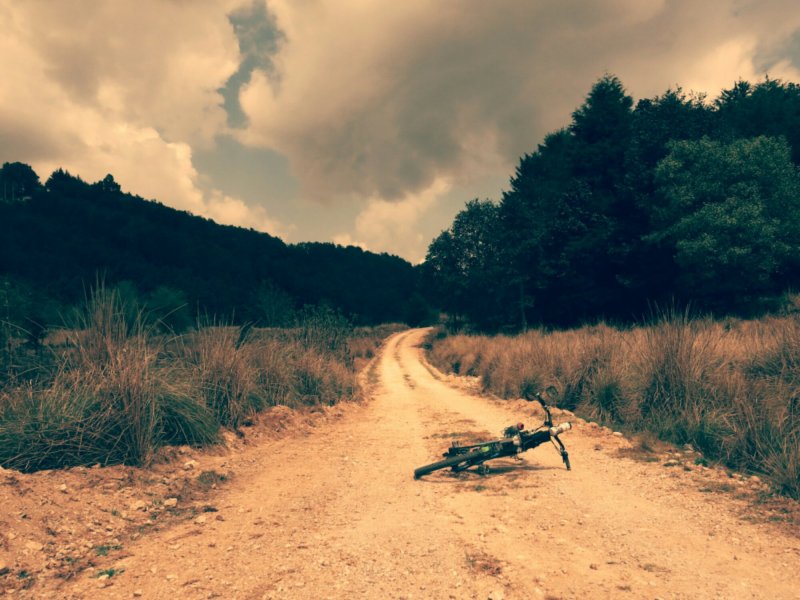
image To escape the city, head into the surrounding mountains. Various iOS and Android apps can supply GPS routes, though the backup option is just to get away from the highways and start on the network of back roads.

image Riding into the countryside.

image To the church at San Juan Chamula, a Catholic church that the local people reclaimed.

image Back in town, past the unmistakable smell and sound of a tortilleria, the machinery within pressing and shaping masa dough into those small discs.

image Bean vendor in the market.

image Lookout onto the city.

image Meet the parents.

image Who bring some gear and clothes, some to swap out, some to use just for the week.

image Travel to ruins, these at Toniná.

image Atop a pyramid.

image To Palenque, massive Mayan site farther east in Mexico.

image Greenery and vegetation, in abundance.

image Alternative transportation.

image Some bike maintenance and tuning.

image Family shot.

image

To San Cristobal de las Casas, Chiapas, Mexico.

Pros: hit a reasonably good wind gap through the Isthmus, buffeted only a little by sidewinds that died down in the afternoon. Lucky. And that same day was flagged down on the road by a WarmShowers host (warmshowers.org, CouchSurfing for touring cyclists), then welcomed into a home for the night. Anyone passing through Zanatepec should look up Rodrigo’s and Lupita’s house, just follow the signs literally painted onto the highway or ask anyone in town.

Cons: struck by first bout of sickness just before crossing the isthmus, but luckily only spent one day emptying my guts everywhere. After witnessing one such episode, a kind woman, Margarita, at a comedor taught me the local word for soup (caldo) and let me crash there for the afternoon and night. Thankful.

image
The Oaxaca to San Cristobal route is bounded on both sides by mountains. First, descend from Oaxaca City down to the coast, exiting the Sierra Madre Sur mountain range. Cue heat and hammock country.

image
Standing water- long time no see.

image
Mountainous treetops to dry lowlands, where shade has even higher value. Note background windmills- a cautionary sign for cyclists, and even drivers here. Winds sometimes blow strongly enough to toss over tractor-trailers.

image
Though the grazing cattle seem to pay the wind no mind.

image
And once the stomach had recovered…

image
Scenery changes.

image
Entering Chiapas sees an immediate shift in road graffiti, nearly all taking on a religious message. San Cristobal de las Casas sits up at 7200′, so getting there involves a roughly 7000′ climb from the lowlands to the surrounding mountains. There are two routes to choose from, the new toll road that does the climb in ~40km, or the old highway that winds through small indigenous villages for a slightly longer 65km. I took the old highway, and even starting early in the morning, didn’t get to San Cristobal until late afternoon. A good climb, great for the appetite!

image
From one set of mountains to the next: welcome the Sierra Madre de Chiapas!

Update from Oaxaca, Mexico.

After a roundabout detour from Mexico City northwest to Queretaro and then San Miguel De Allende, now headed south again. After a good rest in Oaxaca, time to be back on the road soon. Some pics of the last stretch of the ride.

image

image
The old highway from Queretaro to San Miguel de Allende. Google lists this route only under hiking directions, which were fairly accurate, until I either missed a turn or the road just disappeared and I ended up in the middle of a farmer’s cornfield. He was a little surprised to see me there, but gave me directions down a network of driveways back to the actual road.

image
Cobblestone practice. Fatbike time?

image
San Miguel de Allende. Hometown of Ignacio Allende, one of the important leaders of Mexico’s independence from Spain. Another beautiful colonial center, one of many such towns in this part of central Mexico.

image
Also in San Miguel: lots of murals.

image
Cyclist fuel: carnitas, salsas, Coca-Cola. Mexico’s pretty alright.

image
Onto some smaller roads through the mountains from San Miguel, crossing from the state of Guanajuato through Morelia to Queretaro back to the State of Mexico. The State of Mexico is more or less a high plain, surrounded all around by mountains.

image
An abundance of camping spots.

image
Entering into Toluca, capitol of the State of Mexico.

image
Some company for a few kilometers, Pino, Rafael, and David, all out for a ride.

Right off the free highway to Oaxaca City. Smaller than the toll highway, and longer, but beautiful winding up along the pines and oaks before descending into the city. More mountains, more camping spots, just watch out for the cacti. Note: cyclists in Mexico are allowed on the toll highways for free, just ride around the toll booths and ignore the “no bicycles” signs. This is the Mexican way.

image
So much goodness to eat in Oaxaca. Pastries abound in the bakeries, if it has a fruit filling it’s generally a pineapple jam, delicious. Try too the tejate, a corn and cocoa drink, cold and filling. Walk around in all the markets, some open everyday, others, such as the big one in nearby Tlacolula, only held on Sundays, though even on off days there will be some vendors in a few of the stalls.

image
Or maybe just buy a slab of raw meat and sweet onions, which will then be immediately grilled in front of you. Good to go with friends.

image
Aussie Cam takes over grilling duties.

image
Oaxaca is also known for its traditional crafts. Teotitlan is a nearby center of Zapotec weaving, local sheep’s wool is made into thread and dyed with the area plants, to be woven into beautiful rugs or clothing, of every color, shape, and design.

image

image
Will from Oakland on rug hunt.

image
Oaxaca City center by night. Great place to grab a bite to eat, people watch. Great city to relax in, but hard to leave. Hostel Azul Cielo just a few blocks from the center a great base. Next up, just gotta get across the dreaded Isthmus, where Mexico is squeezed between the Pacific and the Gulf of Mexico. Winds are rumored to be quite strong at times…

Queretaro, Mexico. A long-awaited home visit.

Outside of the Sheep Mountain visitor center up in Yukon, Canada, a couple came over and started chatting. They’re from Mexico, and invited me to their home once I made it that far. I finally got there last week, to Queretaro, Mexico, a city northeast of Mexico City, with a beautiful colonial center. Here’s what we looked like, then and now.

Day 20, July 2013:
image

Day 198, January 2014:
image

Thanks Irene and Chris for having me!

Mexico City; DF

A rest, here, for 5 days, the first actual rest in Mexico. Anonymity in the enormous city, in the hostel too, Ace hides in a safe place on the roof so to everyone else at the hostel I’m just some scraggly bearded American wearing the same clothes over and over. Which we’re all doing but rain pants and a cycling cap, what’s with that bro?

image

I’m here with Daniel, below, who biked across the US last year and just graduated from Ohio State, moving to Sacramento soon to start working with AmeriCorps. Thanks for coming to visit!
image

We spend the days touring the city, eating, playing cards. This city is epic, so much character, so much to do. We stayed in the city center by the Zocalo, the central plaza.

image
Coyoacan lies south of the city center. It’s a beautiful colonial center, where Cortes originally built his home until problems with the Aztecs forced him to move back to their part of the city. There are big indoor markets here, street artists outside, cobblestones and elaborate churches. Also apparently an extremely popular coffee shop, just look for the place where everyone -everyone- is walking away from with a take-out cup decorated in the red, white, and green of the Mexican flag. Frida Kahlo’s home, the Blue House, it too is in Coyoacan as well. The house is a kind of contradiction, vibrantly painted, visually beautiful, but the artwork and the history of Frida inside bears witness to the pain and struggle of her life.

image
Coyoacan, colonial, elegant.

image
Then there’s Xochimilco, south-southwest of the center. The area is full of canals, upon which people rent long, flat boats and are paddled around for an hour or two or three, perfect for a little fiesta on the water. Mariachi bands and food vendors float around on boats of their own, entertaining, feeding.

image
Festive.

image
And a day tour to Puebla, a colonial city to the west of the city famed for its churches. Here, the Chapel of the Rosario, was deemed the eighth wonder of the Old World when completed in the 17th century, due to its ornateness. Every surface inside covered with gold gilding, unbelievable.
image
Old World charm in the New World.

image
More, on top of the world, the view from the Pyramid of Cholula, third largest pyramid in the world. Although the Spanish built a church on top of the pyramid, and now the pyramid itself is a tad overgrown with grass and trees, so from many angles tends to resemble a large hill.

image
Other pyramids, in Teotihuacan. We stand atop the Pyramid of the Moon, the Pyramid of the Sun in the background left. Pyramid of the Sun = 7th largest pyramid in the world.

image
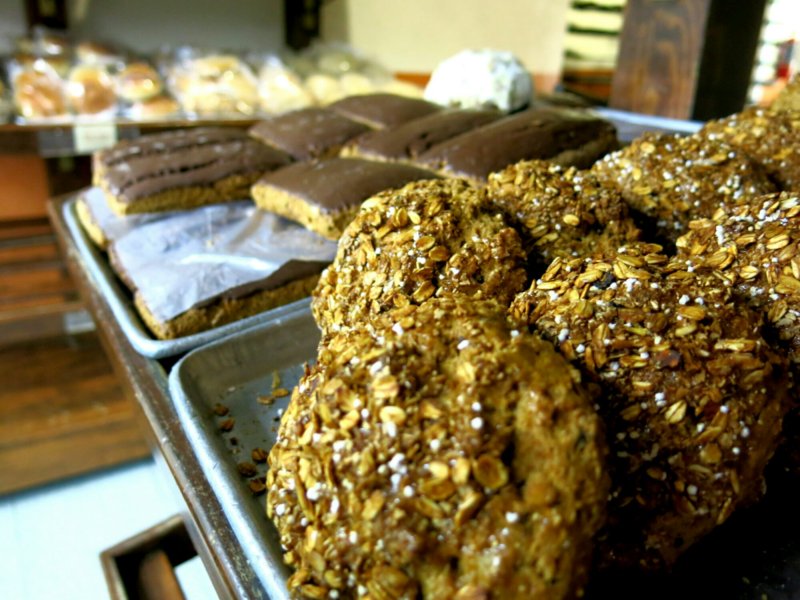
Not to be missed, anywhere in Mexico, are the panaderias. All of these bakeries, phenomenal! Variety in opulence, from sugar-cookies to the Mexican conchas, those balls of soft enriched dough with a hardened sugar coating resembling a sea-shell, to cake “popsicles”, to whole wheat biscuits with a light chocolate coating. We did our due diligence tasting as many as we could…

image
Yes please…

image
Save room for dessert… Or maybe midday snack?
image
Some of the best whole wheat pastries ever. So filling, and so tasty. Those rectangles in the background? Perfect for soon-to-be-less-hungry cyclists.

image
Also, our favorite quesadilla stand in the city. Figuring out the Mexican eating times has taken a little while. Many street food stands are open starting late morning until the evening, but promptly close at 5 or 6. The Mexicans favor a more substantial lunch and a (much later) lighter dinner, not exactly the American schedule.

image
Eating well in Mexico, check.

image
But not everything is fun and games and food. A week or two ago some leaf-cutter ants visited me and the tent one night. Apparently they have a taste for tent mesh, so the inner layer of my tent now has quite a few holes and tears. A morning spent sewing up the worst offenses, productive, though now portions of the mesh look like there are giant spiders crawling up the sides. Quite a sight to wake go to. But so far it’s still usable, so that’s that.

Photos; Northeast Mexico

From the border to the metropolis. Tamaulipas to San Luis Potosi to Hidalgo to El Estado De Mexico. The Mexican people are friendly, always. Sometimes boys in town will ride alongside me for a ways, men wave and smile, though older women tend to shuffle past, studiously ignoring my strangeness. The landscape changes, desert, mountain, city, it’s all here.

image
Sweeping downhills, after the sweaty uphills.

image
Crossing the Tropic of Cancer.

image
Framebag life.

image
In a Catholic country, I tip my hat to every roadside shrine in hopes of making it to the next one safely.

image
Shrimp lunch, dodging the afternoon heat, $6.

image
Sugar cane, by the truckload. We both climb hills at nearly the same speed.

image
Mountain life.

image
Pedestrian walkway that Ace and I are just a bit too wide for.

image
Host, Hipolito, in Matlapa.

image
Tortilleria Lupita, Matlapa. The smell of fresh tortillas in every town ranks highly on the list of good things about Mexico.

image
Urban single track.

image
Aptly named hills.

image
Perched on the edge, winding from town to town.

image
Among the cacti and the rocks.

image
Representing some of the best of Mexico: tacos and Coca-Cola. And the ever-present salsas, ranging from hot to fiery. Quite dangerous to sun-chapped lips.

image
And other dinners, cooked on my tiny alcohol stove. Finding camping spots has rarely been a problem. Those out of sight are best, though cacti and spiky vines tend to imply that the ground will be littered with thorns. My inflatable mattress pad loses a noticeable amount of air during the night by now, though for being older than I am it’s doing pretty good. Plus, the less comfortable it is in the morning, the more likely I am to get moving sooner.

image
Part of the town square in Tizayuca. Wall murals and brightly painted buildings exist everywhere here. Whatever else it may be, Mexico is certainly a pretty country.

Safely in Mexico City

image

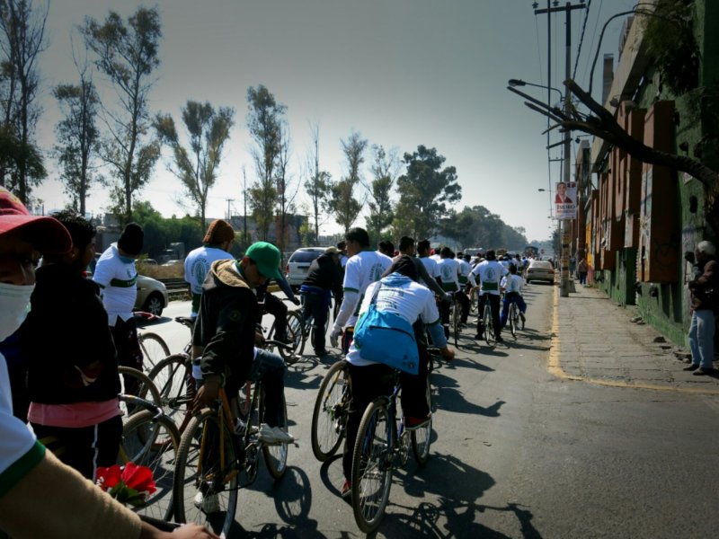
Who needs the hassle of dodging buses and taxis when you can ride in a bike party instead? Outside of Tizayuca, I met a group of cyclists heading to the Basilica de Guadalupe in the center of Mexico City. 120 riders on a pilgrimage, almost entirely riding single speeds with those flared out moustache handlebars. Great to ride in a pack in a city, especially this packed city.

image

Here for a few days with Daniel. Time for tacos, panaderias, and more.

image

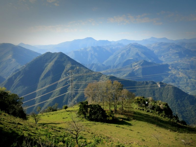
Into the mountains, through San Luis Potosi to Hidalgo.

Through Mexico, such a land of variety. Over the past few days traverse a different climate each day. The changes start with that invisible line, Tropic of Cancer, here designated by a giant yellow ball vivisected by a bold black stripe in the appropriate place. Immediately the humidity descends, welcome back, first time in months. Proceed on the road hemmed in by mango trees on each side, which give way to sugarcane fields and sweltering heat. But it’s harvest time, so the men are out chopping down the stalks with their machetes and piling the bundles into increasingly older trucks that clank by. Soon the mountains begin, ascending first into what looks almost like rainforest, jungle, and more sugarcane, then steadily descending and climbing out of small villages successively selling oranges and grapefruit and mandarins, plantains. At the entrances to many villages banners of flags colored red, green, and white fly. I’m reminded of the stories of prayer flags flying high in the Himalayas; are the ones here on account of the recent holidays or is it just a common tradition in mountains everywhere?

Progress another day or two higher into the mountains, and the tropical trees are replaced by the more familiar pines, with a cactus here or there for good measure. The roads narrow, increasingly hewn right out of the mountain sides, same with the buildings and towns, which become increasingly farther in between. Every so often come to a bigger town which is clearly the center of commerce for the villages surrounding it, with stores and fruit carts lining the main street, and plenty of houses perched on the nearby hills. Outside of these centers there’s a quietude and peacefulness to the hills. Birds soar and tweet, drivers and passerbys imitate them with a language of whistles and calls that take the place of verbal greetings.

Mist and clouds roil about, enforcing that sense of calm in their own way. Will enjoy it while it lasts, another day or two here then heading down to Mexico City to meet up with a cousin. Sure to be an entirely different environment.

Shoutout to Hipolito and family, a cyclist who passed me one day and invited me to his home in Matlapa. Many thanks for showing me around. Cycling community and human kindness extends everywhere.

image

Mexico; Tamaulipas

image

Cross the bridge from McAllen, drop into a world where the chipped paint on the buildings is merely a backdrop for the bold written proclamations of things for sale. Evident right away too is the smell of gasoline fumes, off cars predominantly older but also smaller from their counterparts across the bridge. But there’s also a big public park right across the street too, and at least one in nearly every town big enough to have more than just a main street.

image

Drivers have all been courteous so far. The secondary highways have little enough traffic, and the main ones usually have at least two lanes per side, so plenty of room for drivers to pass. Everyday to Ciudad Victoria featured strong winds coming off the Gulf, so with those and to avoid stressing my knee I’ve been sticking to 100km days. Nice to be back in the metric system again, though Celsius temperature reports still take some getting used to. The weather warmed up again, sunny cloudless sweat-filled ice-cream-in-the-afternoon days.

image

From Ciudad Victoria, heading more or less south with mountains looming visibly to the west. Need to improve my Spanish pronto, the usual anticipated questions aren’t too bad but everything else takes a few seconds to process. Thankfully there’s time, and nowhere to go but up. Until next time.