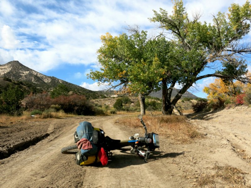
Costa Rica, part 2: the Beach.

imageFrom Arenal to the Caribbean coast. Once again I rode only lightly loaded, and caught up to Michael and Mario and the rest of my gear a day later. Testing some setup options for upcoming parts of the ride.

imageDown out of the mountains, banana farms dominate the landscape. They stretch on for miles, green shrubs towering and shading the fruit. Close up, the trees look like they’re growing giant blue fruits, since plastic bags cover the banana clusters to protect and maintain their environment. All of these were property of Chiquita; Dole also harvests a lot from this area.

imageJust be careful that you’re not passing through during a spray fly-over…

image Coast in sight! Continuing the cycling ping-pong game between the Pacific and Caribbean waters.

image And then the rest of the ride down the coast, my only company was constant crab remains. They’re not too great about making it across roadways.

image But wait! Found alive, replenishing their population numbers. They can be very… crabby… about having their pictures taken.

image Catching back up with Mario and Michael, we spend a few days on the beach at Puerto Viejo.

image I’m taking some rest days from the bike, others are wandering around on beach cruisers.

image Coconut trees abound.

image Old boats sit waiting, nothing’s so old it won’t still be used.

image All along the water, small groups of people swim or run through the sand.

image And lounge about waiting for sunset.

image In Cahuita, 10km north, a protected national park hugs the coastline. The hike here is a much more relaxed affair than at Arenal, though a rainstorm swings through soon after we start out and hampers our ability to see much.

image But we at least start out under the sun.

image Always on the lookout for oil, even back in 1910.

image A restful few days and a good end to a visit. From Puerto Viejo, Mario and Michael went back to San Jose to fly home, and I set off for Panama. Only one more country left in Central America. Just gotta cross that Sixaola bridge.

image Easier by bike than with a roller bag, just watch your footing. If it ain’t broke…

Costa Rica, part 1: Mountains.

imageFirst order of business: meet up with these guys. Michael and Mario came down to visit and vacation before school starts up again. Thanks for the new coffee mug and other supplies!

imageWe met up at Monteverde, one of Costa Rica’s premier cloud forests. Note: cloud forest implies the place is in the clouds. High up. On top of the mountains. This is all true. It’s an important thing to keep in mind when you tell the non-cyclists to choose a place to meet. Good Andes training though.

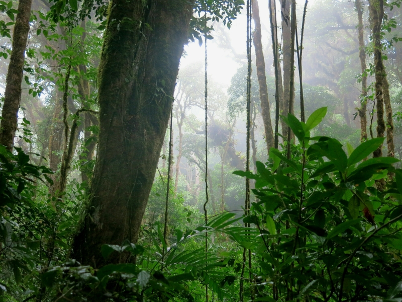
imageCloud forest, home to ever present moisture and fog, creating an extremely fertile habitat for all kinds of species. A welcome break from the heat.

image Spotted in the forest: the Quetzal bird of Central American lore. These birds are talked about everywhere (Guatemala’s names its currency after them), but Costa Rica is one of their few homes. Above is the male…

image And the female.

image Also these guys. The tentacles are a parasitic fungus that killed the beetle and are now using the nutrients from the body to grow. Life is crazy.

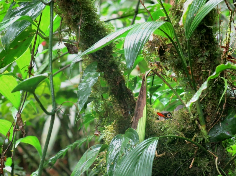
image Hanging out in the nest.

image These ain’t your stunted little Alaskan trees from the far north anymore.

image Outside the forest itself, back to blue skies.

image And then time to move on. Our next destination was Lake Arenal, less than a day’s ride away. Eager to ride out of the mountains, Michael and Mario took some of my gear with them by bus, and I met them later that day.

image Formed by the Arenal volcano, the trip from Monteverde to Arenal requires a bus to the edge of the lake, a boat ride across it, then another bus to La Fortuna or one of the other towns at the base of the volcano. By bike, there’s a great dirt road ringing the lake.

image Rideable, with a few streams to ford. These are very effective at keeping down traffic.

image Together again, we trekked to the La Fortuna waterfall.

image Whose small collecting pool provided quite the workout to swim in.

image Afterwards, we set out on the hike up to Cerro Chato, a crater lake in there inactive volcano next to Arenal. Inactive volcano, good for hiking. Active, less so.

image Though billed as only a 7km hike, it’s a brutal test of your legs and knees as you heave yourself up rough hewn steps, slowly clambering up the side of the volcano. For hours.

image Peaking with a view of Arenal.

image And then a 100m climb/slide down to the lake, by which point you’re probably just as soaked with sweat as if you had already gone swimming.

image Green is a pretty reoccuring theme here.

image The next day a good day for body recovery and some bike maintenance. Time for an oil change.

image Oil, clean on the left, dirty on right.

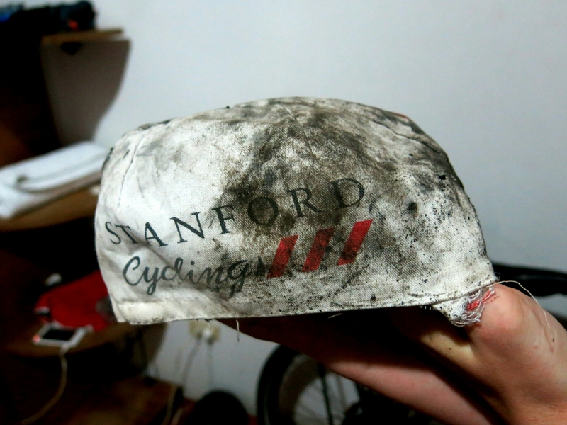
image And finally saying goodbye to an old cycling cap. Anne and Kamil brought down this guy’s replacement back in Guatemala, and I’ve been carrying this one just as a spare since. Its sees its final use as an oil and chain cleaning rag.

Next up, to the beach!

Guatemala.

imageBit of a catch up post, Guatemala is now over and done. Left San Cristobal and Mexico with Sebastiaan, from Belgium, backpacking the last 6 months down from New York, now giving biking a try. Pretty sweet to be riding with company again.

image Sebastiaan.

image Relinquishing the relative coolness of the mountain heights of San Cristobal, descending to the jungle below.

image Where waterfalls make the perfect afternoon rest stop. The road from San Cristobal to the Mayan ruins at Palenque boasts two huge falls, where everyone goes. The road from Palenque along the Guatemalan border also hosts several waterfalls, a little smaller, but much less crowded and great places to relax.

image 7am river crossing to Guatemala.

image Where we’re welcomed and escorted through the village.

image The first two days across the border are spent crushing a hardpacked dirt road to Flores. Great riding, if a tad dusty.

image Ever present heat = frequent drink stops.

image At Flores, meet up with Stanford friends Anne and Kamil to explore the Mayan ruins of Tikal. Great choice for spring break, guys! Thanks for visiting!

image Tikal temple.

image Looming high, steps to the sky.

image Photo credit to Anne/Kamil.

image Credit again to Anne.

image After a few days rest, back on the road, heading into the mountains to Semuc Champey. First on asphalt…

image Then onto 24hrs of loose and rocky climbing, up, down, breathless, recover, struggle another few hundred meters, repeat. Practicing for the Andes again.

image Up high, at the end of the steepest section, Jorge and his family offer us a place to sleep for the night.

image Setting out the next day, after a few hours a forced rest stop waiting for the road to clear.

image And finally, the start of the descent.

image To the Semuc Champey pools. Time to swim!

image A short rest first.

image Water park playground.

image

image From Semuc, we head back east to the Caribbean coast and into Honduras. The last stretch of road to the border is lined by some of the banana and pineapple plantation remnants of United Fruit Company and Standard Fruit Company. Proximity to which ensures plenty of cheap roadside fruit vendors.

image Next up: Honduras, country #5.

Border hopping, Mexico to Guatemala to Mexico.

imageA friend from Iowa City, some time in Germany, lived in Mexico City for a while, in Chile currently- we met in California- has Guatemalan roots and says she’ll be visiting there for a few days. I’m some muddled mix of European gringo roots, am in Mexico, and that’s close enough to arrange meeting up. Slightly too far to bike in time, which is maybe a blessing after seeing the mountains between San Cristobal and Guatemala City. So instead Ace gets stashed in a hostel in Mexico, and I jump on a few buses. There and back in a few days- fast transit! Ximena, good to see you!

imageThat border crossing. Full of money changers and street vendors selling every type of clothing or knick-knack you might want.

imageThat bus- first class! I.e. what only tourists take.

imageAnd back to Mexico!

Mexico City; DF

A rest, here, for 5 days, the first actual rest in Mexico. Anonymity in the enormous city, in the hostel too, Ace hides in a safe place on the roof so to everyone else at the hostel I’m just some scraggly bearded American wearing the same clothes over and over. Which we’re all doing but rain pants and a cycling cap, what’s with that bro?

image

I’m here with Daniel, below, who biked across the US last year and just graduated from Ohio State, moving to Sacramento soon to start working with AmeriCorps. Thanks for coming to visit!
image

We spend the days touring the city, eating, playing cards. This city is epic, so much character, so much to do. We stayed in the city center by the Zocalo, the central plaza.

image
Coyoacan lies south of the city center. It’s a beautiful colonial center, where Cortes originally built his home until problems with the Aztecs forced him to move back to their part of the city. There are big indoor markets here, street artists outside, cobblestones and elaborate churches. Also apparently an extremely popular coffee shop, just look for the place where everyone -everyone- is walking away from with a take-out cup decorated in the red, white, and green of the Mexican flag. Frida Kahlo’s home, the Blue House, it too is in Coyoacan as well. The house is a kind of contradiction, vibrantly painted, visually beautiful, but the artwork and the history of Frida inside bears witness to the pain and struggle of her life.

image
Coyoacan, colonial, elegant.

image
Then there’s Xochimilco, south-southwest of the center. The area is full of canals, upon which people rent long, flat boats and are paddled around for an hour or two or three, perfect for a little fiesta on the water. Mariachi bands and food vendors float around on boats of their own, entertaining, feeding.

image
Festive.

image
And a day tour to Puebla, a colonial city to the west of the city famed for its churches. Here, the Chapel of the Rosario, was deemed the eighth wonder of the Old World when completed in the 17th century, due to its ornateness. Every surface inside covered with gold gilding, unbelievable.
image
Old World charm in the New World.

image
More, on top of the world, the view from the Pyramid of Cholula, third largest pyramid in the world. Although the Spanish built a church on top of the pyramid, and now the pyramid itself is a tad overgrown with grass and trees, so from many angles tends to resemble a large hill.

image
Other pyramids, in Teotihuacan. We stand atop the Pyramid of the Moon, the Pyramid of the Sun in the background left. Pyramid of the Sun = 7th largest pyramid in the world.

image
Not to be missed, anywhere in Mexico, are the panaderias. All of these bakeries, phenomenal! Variety in opulence, from sugar-cookies to the Mexican conchas, those balls of soft enriched dough with a hardened sugar coating resembling a sea-shell, to cake “popsicles”, to whole wheat biscuits with a light chocolate coating. We did our due diligence tasting as many as we could…

image
Yes please…

image
Save room for dessert… Or maybe midday snack?

image
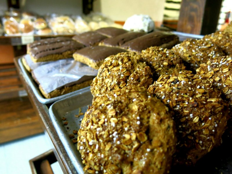
Some of the best whole wheat pastries ever. So filling, and so tasty. Those rectangles in the background? Perfect for soon-to-be-less-hungry cyclists.

image
Also, our favorite quesadilla stand in the city. Figuring out the Mexican eating times has taken a little while. Many street food stands are open starting late morning until the evening, but promptly close at 5 or 6. The Mexicans favor a more substantial lunch and a (much later) lighter dinner, not exactly the American schedule.

image
Eating well in Mexico, check.

image
But not everything is fun and games and food. A week or two ago some leaf-cutter ants visited me and the tent one night. Apparently they have a taste for tent mesh, so the inner layer of my tent now has quite a few holes and tears. A morning spent sewing up the worst offenses, productive, though now portions of the mesh look like there are giant spiders crawling up the sides. Quite a sight to wake go to. But so far it’s still usable, so that’s that.

Houston, to New Orleans and back. Hanging out for the holidays.

Sometimes, there always seems to be a reason to stick around somewhere longer than planned. Such is currently the case in Houston. Came to visit Sarah, go to visit Lydia in New Orleans when Sarah leaves, madre flies in to visit Lydia and me so I drive to Louisiana with her and eventually drive back to Houston to where I left the bike. Then the Lloyds are kind enough to invite me to stay for Christmas so I do that too. But that’s not even the end, since Facebook informs me that another good friend is in Houston for the holidays, so gee, might as well stay another day to see Fady. Why not?

image Family time.

image Friends time.

Someone asks if I consider driving/hitching/any other form of transportation cheating; I don’t, because the bike is merely the primary facilitator of this journey, and why close doors by being inflexible? It’s a nice goal, to stick with the bike 100% of the time and accept whatever comes, but sometimes other things take priority. In the end, the number of miles traveled off the bike will be negligible compared to on the bike, so that too puts the engineer’s mind to rest.

Chapter 1-USA/Canada-of this trip is almost over. Part of the reason I’m here is to travel through Latin America, and biking is the best way I know. The riding will be difficult, so will the language change, maybe water too, more? ok, so be it. Hopefully everything so far has been good preparation, but regardless, at this point the die have been cast, time now to ride out whatever comes. Forward, forever onward.

image Time with the Lloyds on the beach. Back at the water!

image Learning to pick prickly pears time with Hyang. Though contrary to the name, they actually taste more like apples.

image NASA time.

image

So ends this portraits post.

Day 143. Paducah, TX to Lawton, OK.

image

4:30pm. Roll out of the gas station where I’ve stopped for a Coke, 20min later than expected because a man on a Harley pulled up then. He looked at Ace like he wanted to talk, so we did, though the conversation was pretty one-sided since he could never hear me. Leaving town-Frederick, OK-google routes me onto the maze of dirt country roads that are laced between all the farm plots here, each at least the size of a square block and filled with crops. Dirt’s all dried from last week’s snow, so cruising is good. Pass cotton fields still filled with the white flowers, they look like a sea of snow until you get close. Cattle graze or rest in some plots, and others have cornstalks left from harvests, or green grass. Three and a half hours from Frederick to Lawton, promise of seeing someone again keeps me going, already been on the bike for 100miles today, woke up before dawn, got to see the sun rise. Temperature drops at the end of the day, not cold but cool. Even the slight valleys here are noticeably cooler in their bottoms, making the return to the top feel that much warmer. See nearly no cars, listening to podcasts for company in the emptiness. Arrive safely, into a warm house and warm embraces.

image

Too bad it’s winter now and the sun sets at 5pm.

image

Back to the present: next stop, Oklahoma.

Image

Following great visits to Deanna and Christian in Phoenix and then Colleen in Tucson, right now I’m bouncing between homes. I’ve crossed back into New Mexico headed east a ways. New Mexico is easily becoming one of my favorite states, with friendly people and sights and food, none of it to be missed. I rode and then had to hitch the final few miles into Las Cruces to the home of the Currys, who welcomed me in just as a storm came rolling into town. If anyone finds themselves in the area, Coas Bookstore is go-to destination. Headed next to Ruidoso to investigate word of a delicious little hole-in-the-wall Mexican restaurant, leaving the towering pecan trees here to return to the pines before crossing a reportedly empty stretch to Lawton, OK. After that, Texas bound. I’m ever so slowly finding my way south to Mexico.

Through New Mexico; an end to the Divide

From the high mountains to tacky mud and rocky mesas. The Southwest provides a change in scenery.

image

The change from trees to rocks happens nearly right after crossing the Colorado border.

image

The warnings in the Divide maps for New Mexico are all about rain, which apparently changes the dirt here into an impenetrable mud. Storms brewing diverted me to a lot of road alternates for this section of the Divide, which ultimately worked out well. Here I pitched my tent for the night with Kirk, who has been hiking his way south from the Canadian border in June along the Continental Divide Trail. The CDT sticks as close to the Continental Divide as possible, whereas the Great Divide biking route sticks more to dirt roads that parallel the Divide. Kirk would be the first of the CDT hikers I got to meet, for while there aren’t many bikers riding the Divide this late in the year, November is apparently when many of the southbound CDT hikers get to New Mexico. Fun group of people, and interesting to see some of the differences between long-distance hikers and bikers. I think we both raised our eyebrows at each others’ paces.

image

Goats in Abiquiu, where I got to spend a day resting with Santana’s family.

image

And a backroads route away from their home, getting in a dirt fix.

image

Mostly firm dirt or slick rocks, with a few patches of sand mixed in. Good riding.

image

Abiquiu Dam, one of the only pockets of surface water I saw in New Mexico. Thankfully it wasn’t too hot, or carrying a lot more water would have been necessary.

image

And in Cuba I got to stay with more family. What luck, and thanks to all! Chopped up plenty of wood with Eddy to keep the house warm through the upcoming storm.

image

On the road from Cuba to Grants, amidst an ever-changing sky.

image

Mesas, jutting out one after the other, providing relief from an otherwise flattish landscape.

image

When the road turns to sand, wider tires are better. Here I probably should have let more air out to make the going easier.

image

The area is also known for old lava flows that have hardened and are now used as waking paths.

image

Heading for Pie Town, my final destination on the Divide. Getting close. Pie Town is home to two cafes renowned for their pie, of course. Legend has it the town was started when an entrepreneur found out a highway was coming through the area, and decided to sell pies to the travelers coming through. Now there’s a huge festival dedicated to the pies earlier in the fall, but a well-connected community lives there the rest of the year. One woman, Nita, leaves a house open for all the bikers and hikers coming through, making the town a great meeting and resting place. The pie certainly helps, too.

image

If you ever needed a reminder that this is still the West…

image

Made it!

image

Sampling the delights at the Pie-O-Neer Cafe. A slice of cherry to start…

image

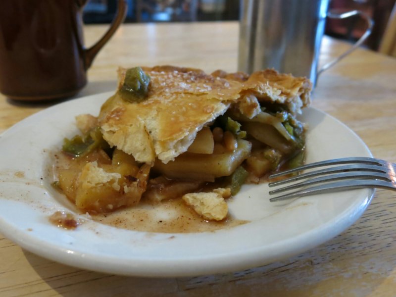
Followed by a piece of New Mexican apple. Apples cut up with pine nuts and green chile, for a little kick. Would definitely have been a good one to have a la mode.

image

Nita’s house is called the Toaster House, and anyone in town can give you directions to it. With beds, a kitchen, showers, laundry, and food in the fridge, I think we all ended up staying a day longer than we planned. Four CDT hikers were enjoying a day off when I arrived, and another arrived the following day with word of 3-4 others a day behind him. The hikers are very organized, to the point where they shipped all (or at least most) of their food supplies ahead at the start of the trip and pick them up whenever they get to a town. Luckily for me, many were progressing through New Mexico faster than expected, so they had a lot of extra food they didn’t need. I’m now trying some of their homemade dehydrated foods (rice and beans or Tuna fish casserole anyone?) for my camp dinners.

image

In front of the Toaster House, saying goodbye to a fun town in a unique state.

Arrived in Phoenix.

In Phoenix for a week or so of rest. Drinking water, lots, iced, because Phoenix is hot, dry, and sunny. Acero is currently sitting on the apartment balcony getting a tire change. Losing the knobbies that got me out of Colorado’s snowy slush and mud, back to the slicker Mondials that took me everywhere prior to Manitou Springs. For anyone interested, the Mondials are 2″ wide, and were fine for the Divide. There were a few descents where knobbies would have been appreciated, but not necessary. It’s also time to check brake pads, and maybe replace my cracked mirror. Will talk about this and more in some posts coming soon, as well as about the ride from Colorado to New Mexico to Arizona. But here’s some of what rest life looks like.

ImageDeanna, host, rocking the thumbs up.

ImagePicking up many packages; some bike parts, some gear to swap on the bike, some fruit from home.

ImageMaking dough, for many things. Taking advantage of having a kitchen to use.

ImageChristian flies in from Michigan to visit too.

ImageCarbs. Gotta get in a pizza fix since (at least so far) my Arizona route hasn’t gone through Flagstaff, home of Pizzicletta.

ImagePlus bagels, Haus Mitt heritage, putting to use some of the things Renny taught me. Food is essential to recovery, always.