Two big things to close out Panama. The first a big cut through the Earth, took 33 years to complete, 1881-1914. The second a cut through the continuous network of roads from North America to South America.
 Looking east.
 Right outside Panama City, the Miraflores locks equalize the water level before ships exit to the Pacific Ocean.
 And ships slowly inch along, pulled through the locks by the gray locomotives.
 Standardized shipping containers like these hold bulk cargo. The freighters carrying these are built to Canal specifications, and pay tolls in the hundreds of thousands of dollars. The Canal is used today for nearly four times the capacity it was estimated for, and it’s still not big enough. Construction is ongoing to let bigger ships through.
 Then headed out for one last stretch of riding in Central America. 2 days from Panama City to Carti on the Caribbean coast, the start point for speedboats down to Colombia.
 The last 40km (starting with the turn off the Panamerican) are brutally steep up/down pitches back over the mountains. Easily some of the steepest so far on this trip, but none of the climbs are very long. If starting this section on the 2nd day, there’s a good fonda for coffee and food with very friendly Kuna people at km 13. Good time for a break by that point.
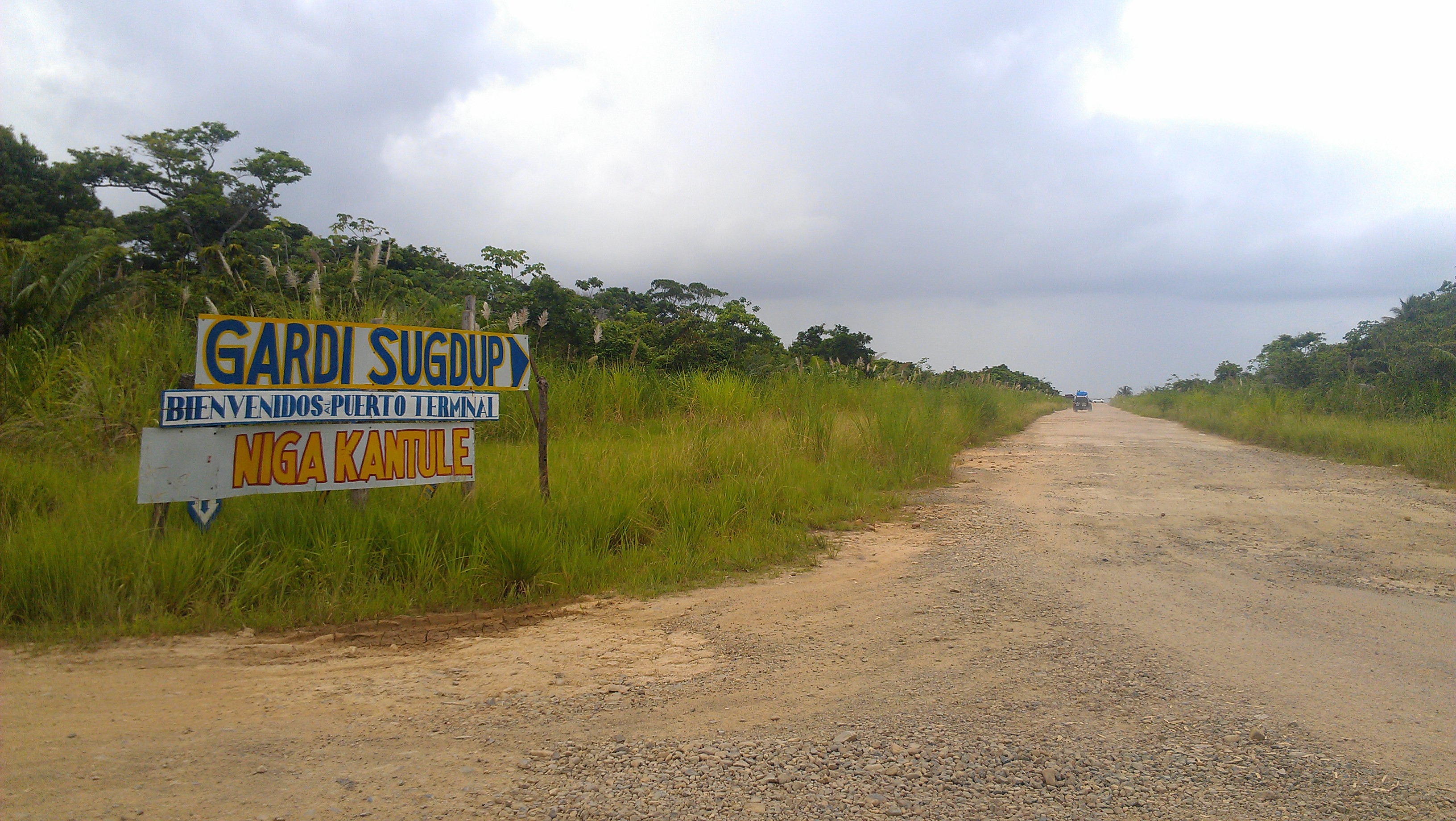 Arriving in Carti, it is impossible to get lost. Ride down the airstrip to the port, everyone is used to seeing bikers and can easily direct you where to go. You can either catch a boat taxi over to Carti the island right away (5min ride) and catch the boat there the next morning, or wait on Carti the mainland and start with the boat in the morning. I stayed on the mainland, mainly because I didn’t want to go to the island and have to pay for a hotel for the night and the boat captain said I could just sleep in the boat if I wanted. This was not entirely the best idea. The mainland is very peaceful at night, only one family lives there and there is nothing around the port. Everyone there during the day returns to their homes on the island, so there’s probably more life and action there. Sleeping on a boat is not the most comfortable experiece, because even though you can make a comfy mattress with all the life jackets on board, it continuously rains intermittently through the night, you will get damp. But be glad for the rain, when it rains the tiny mosquitos or sandflies go away. Those mosquitos are hell. After 3 hrs I gave up and set up my tent on land and slept until morning.
![IMG_20140615_155352[2][1]](https://steelingaway.com/wp-content/uploads/2014/06/img_20140615_155352211.png) Small map of the Dairen Gap. The Gap is a missing section of roads between Panama and Colombia (really the only missing section between Alaska and Argentina), about 100miles long on the Panama side and 60miles long in Colombia. Home to messy swamps, mountains, and numerous guerilla forces. The last reported crossing by bike was Ian Hibell in the 70s, and various people have walked through between then and now, but the guerilla forces have also become much more prevalent since then. I’m a little skeptical about the claim of no roads- even muddy singletrack trails would be passable on bike- but the unanimous opinion is that the paramilitary forces are very dangerous. So I took a boat around, of which there are many.
Small map of the Dairen Gap. The Gap is a missing section of roads between Panama and Colombia (really the only missing section between Alaska and Argentina), about 100miles long on the Panama side and 60miles long in Colombia. Home to messy swamps, mountains, and numerous guerilla forces. The last reported crossing by bike was Ian Hibell in the 70s, and various people have walked through between then and now, but the guerilla forces have also become much more prevalent since then. I’m a little skeptical about the claim of no roads- even muddy singletrack trails would be passable on bike- but the unanimous opinion is that the paramilitary forces are very dangerous. So I took a boat around, of which there are many.
![IMG_20140614_183501[1]](https://steelingaway.com/wp-content/uploads/2014/06/img_20140614_1835011.jpg) The two main options for boats are to take a swanky 10-20 person yacht on a 4-5 day cruise through the San Blas islands, stopping and swimming and enjoying yourself along the way, or to take a series of speedboats down the coastline for 2 days, visiting a few San Blas islands, but stopping only long enough to pick up passengers and drop off supplies. I took the speedboat option, wanting to get to Colombia sooner. The San Blas islands are home to the Kuna tribes, indigenous people who live in this section of Panama and maintain nearly autonomous control over their lands. Very friendly people, but it’s considered rude to take their picture so not too many photos of this stretch.
The two main options for boats are to take a swanky 10-20 person yacht on a 4-5 day cruise through the San Blas islands, stopping and swimming and enjoying yourself along the way, or to take a series of speedboats down the coastline for 2 days, visiting a few San Blas islands, but stopping only long enough to pick up passengers and drop off supplies. I took the speedboat option, wanting to get to Colombia sooner. The San Blas islands are home to the Kuna tribes, indigenous people who live in this section of Panama and maintain nearly autonomous control over their lands. Very friendly people, but it’s considered rude to take their picture so not too many photos of this stretch.
![IMG_20140614_183514[1]](https://steelingaway.com/wp-content/uploads/2014/06/img_20140614_1835141.jpg) Out at sea.
Out at sea.
![IMG_20140614_183609[1]](https://steelingaway.com/wp-content/uploads/2014/06/img_20140614_1836091.jpg) Looking back at shore.
Looking back at shore.
![IMG_20140614_183811[1]](https://steelingaway.com/wp-content/uploads/2014/06/img_20140614_1838111.jpg) We had two huge drums of gas to get from Carti to Carpurgana. We refueled at 5hrs in. The guy running the boat turns on the engines full power as soon as he’s away from the islands and doesn’t stop. When going to a storm, plastic tarps and handed out and everyone huddles under these. Our crossing ended up being pretty fast at only 7hrs from Carti to Puerto Ovaldia (exit point of Panama); others reported it taking 9-12hrs.
We had two huge drums of gas to get from Carti to Carpurgana. We refueled at 5hrs in. The guy running the boat turns on the engines full power as soon as he’s away from the islands and doesn’t stop. When going to a storm, plastic tarps and handed out and everyone huddles under these. Our crossing ended up being pretty fast at only 7hrs from Carti to Puerto Ovaldia (exit point of Panama); others reported it taking 9-12hrs.
![IMG_7333[1]](https://steelingaway.com/wp-content/uploads/2014/06/img_73331.jpg) Colombian coastline! You’ve arrived when you pass that big rock in the middle of the water.
Colombian coastline! You’ve arrived when you pass that big rock in the middle of the water.
Going by speedboats is a faster trip, but rough, especially for bikes. They go in the front of the boat on top of all the other luggage. The boat guys aren’t the gentlest when they need to take something out of that pile of luggage. Everything gets soaked, over every wave the bike just jumps up and down. You bounce up and down in your seat too, but it’s worse seeing it happen to the bike. Carpurgana is the first port in Colombia and is a world away from Puerto Ovaldia, the port where you stamp out of Panama. Puerto Ovaldia is a town of a few streets with not much going on; Carpurgana is a big tourist destination for Colombians and every other house is a hostel. From Carpurgana, you still need to get to Turbo, the Colombian port you can bike away from, but there’s a daily speedboat to Turbo around 8am. Supposedly you’re allowed 10kg of luggage on the boat to Turbo (weighed via a scale on the dock). In reality, I was charged a fee for the bike and then whatever bags the boat guy could weigh, he did, and then made up an amount based on that. This seems standard procedure. All in all, costs from Panama to Colombia were $150 from Carti to Carpurgana, $40 from Carpurgana to Turbo. Plus $5 for a hostel in Carpurgana. And meals in between. But at $195, far cheaper than the $575 yacht trip. A plane might be still cheaper, and much faster, plus less hard on the bike, but you miss out on the islands completely. Regardless, you’ll get to Colombia, and say hello to South America!


