Day 78. Outside Rawlins to the National Forest, just before Colorado.

Wow. Today was tough, though now, lying comfortably and warmly in my sleeping bag, the day’s difficulty is slowly seeping away. The wind slammed us as soon as we got on the bikes; Wyoming seemed not to want to let us out of its clutches. We rode 51km today, and it was an all day effort, averaging probably 7, maybe 8km/hr in the morning, and thankfully we were probably doing 10 or 11km/hr in the afternoon. Don’t even bother converting that to mph. Talking this morning at breakfast, we didn’t expect to go farther than 45km, but here we are.

We had a good dinner tonight. Virgile and Marion are quite proficient fire-makers, so we had a nice one to huddle around and get warm. Almost everyone who drove by us and talked to us today said we’re crazy to be riding the Divide this late, and that it’s going to snow tonight for sure, we’d better get moving. One man was quite rude about it, insisting we’re the last riders of the season, when who knows, there could easily be someone behind us, especially if they came down from Alaska and started there a week or two after we did. People have ridden the Divide later than we are now, and if the snow gets too bad, then it’s just time to find a different route. Maybe everyone’s just excited because this will be the first snow of the season. Whatever happens, for now we’re safe in our tents, and once we reached the forest, the killer wind died down. Cold we can deal with, especially with climbs to warm us. But wind, headwind, is just mentally-draining, an invisible force against which we can do nothing but put our heads down and struggle against. It won’t be the last headwind we encounter, though. Headed to Patagonia, where it’ll be a toss-up whether we get lucky and catch tailwinds across the region or will be fighting headwinds the entire time. There the winds are legendary. This is just practice.

imageStrong winds and gravel roads make a good argument for biking with nose and mouth covered.

imageJust keep riding.

imageSo windy that pushing is as fast as walking.

imageRefuge in the forest.

Day 75. A&M Reservoir to before Rawlins.

Windy night, had trouble sleeping because of the tent sides flapping around. But up early, sun hits the tent almost as soon as it rises in the desert, nothing around to block it. We make oatmeal and coffee, rationing and closely monitoring our fuel use to last all the way to Rawlins. Great Divide map listed Atlantic City as having ‘all services’ but apparently this doesn’t include gas stations, so Marion and Virgile are running low on fuel. I have just enough alcohol left that we scrape by. Today marks our third day in this desert, we camp just outside of Rawlins tonight and then will spend tomorrow in the city. The Divide maps say that this section of the route has the least water north of New Mexico; coming through in September, we found at least one place to resupply each day, more than we expected, so we’re carrying more water than we needed. But it’s been hot during the day, so maybe earlier in the summer we would have drunken a lot more water.

First 20km of the day are almost straight into a headwind, but we form a paceline and push through it. Then we turn left and after 5km the wind changes to a massive tailwind, propelling us forward for 30km to the junction where we stop for lunch. We can see storm clouds brewing, the first clouds seen after three days under the endless blue sky in the desert, so we eat lunch under the body of some construction vehicle. The storm breaks just as we finish lunch, so we spend the next 45min huddled under this machine staying warm until the storm passes. Then only 10km to our campsite for the night, we get the tents up and Virgile makes a big fire where we recover from the chill of the storm and cook and drink coffee and hot chocolate.

I’ve crossed the Continental Divide 9 times now on the route. The desert we just came out of is called the Continental Basin, where water drains neither to the Pacific or Atlantic but stays trapped in the ground where it falls. I had no idea this kind of landscape existed in the Rockies, thinking it was all just rocky ground and mountain forests. In three days of riding we spent nearly every single moment alone, the only other people we saw were the occasional hunters (hunting the antelope that roam this desert) and on the second day, some oil workers. The basin is said to have more oil than Saudi Arabia, all shale oil, and if it starts getting developed this section of the Divide will be very different in a few years for sure.

Will be in Colorado in just a few days now, headed for the towns of Steamboat Springs then Silverthorne then Salida to Manitou Springs, is the current plan. Will either then continue riding the Divide into New Mexico or alternatively head into Oklahoma/Texas then west to Arizona. And so the ride continues.

image

In the desert.

image

Three bikers together.

image

Last tree for three days.

image

Chilly mornings are common now.

image

Continental Divide crossing number 5.

image

This little guy was digging big holes in the road.

image

Weather climbing up to Union Pass.

image

We climb, always.

Jackson to South Pass City, WY

Left Jackson, with a face I don’t entirely recognize and without a razor that no longer works. Cycled north to a campground with hiker-biker only spots, no one else is there, though the drive-in camping spots are all full. Stop just outside the campground to chat and join the Logans for cocktail hour, who provide salmon and peanuts for appetizers and buffalo jerky for the road ahead, which comes in handy a few days later atop one of the passes. I eat dinner right before I crawl into the tent at night to read/write/whatever. Lately have been cooking or eating at least partially by headlamp, but now everyone’s pretty much back at school and there are no more immediate deadlines to meet so hopefully the days of cycling will get shorter with more rest time and earlier stops.

Back on the Divide the next day, this week getting mostly out of Wyoming involves climbing over nearly one pass per day, and hence at least one crossing of the Continental Divide. The fourth day out has two crossings. Climbs overall not bad, the narrative makes the climb up to Union Pass sound ominously difficult but it’s just long and gradual, not too steep at all. Maybe would be a different story if the road was wet and muddy. The area between Tegoetee Pass and Union Pass seems to be caught in a round of storms, the sky overhead constantly going from blue to black. The storms generally only last about 20 min or so, just have to bike with a constant eye on the sky and watch for stands of trees or building overhangs to take cover under when the storm lets loose.

Depending on how long the climb to the passes takes, sometimes I end up camping right near the top after going through, if there’s no time or energy left to descend. Hence my highest camping spot has now been at over 9500′, and it was cold in the morning until the sun came up. Camping on the southern side of Union Pass made for an interesting night; finished dinner and had just climbed into the tent when the circling storm clouds let loose. First just thunder and lightning right around the tent, then a bucketing of hail that turned all the ground white. Some patches were still left in the morning, though thankfully no ice in the water bottles so must have been just above freezing. I picked up some winter mittens in Jackson and they do indeed work.

Am back to riding with Virgil and Marion again, caught up to them five days after Jackson, on the ride to South Pass City. South Pass City marks completion of the second portion of the Great Divide, and wow, what a ride. A tailwind pushed us through high, sage-filled grazing grounds, almost deserts, expansive with no end in sight except the mountain ranges on all borders. We dart through the ranges at South Pass, right where two of the ranges seem to intersect, and the desert starts immediately after. After South Pass City we have a two day ride with little water, so we’re loading up with 2-4 gallons each. Good to be riding with company again.

Colorado looms next in the distance. Feels like a promised land of sorts, means successful completion of several portions of the Divide and some wonderful people to visit. Plus I flew out of there almost three months ago for Alaska, didn’t really expect to be back so soon. Have to do some route planning once I hit southern Colorado, options for immediately after include going south-east, south, or south-west. But good to have options.

The Great Divide: Through Montana to Wyoming

One week now on the Great Divide. I am blown away by this trail- never been on anything like it. The roads that my map and instructions direct me down are gravel forest service roads through the National Forest, or old roads that used to be the supply routes between towns in the 1860s but are now “scenic byways” that no one else is on. Through southwestern Montana the roads were beset on all sides by huge ranches, generally arid sage landscapes with cattle grazing all around. The cattle are not at all phased by bikes rattling down the roads until you’re within about 5 feet of them. The ACA route directions and a working odometer are vital to staying on the trail, and even with both of those, it is still quite easy to get lost. Seeing tire tracks from other bikers on the trail before you are good indicators of where to go at a fork in the road.

If you’re at all thinking of riding the Divide- do it. You won’t be sorry. Tired maybe, but not at all sorry.

image

Immediately after joining the trail in Butte, I climbed to my first crossing of the Continental Divide and set up camp there for the night. It would have been a very quiet night, no one else around, except that hunting season has evidently started, and in some parts of the National Forest hunters are roving around in their 4x4s.

image

Clear skies and a crisp morning. According to the route profile, the trail so far is always above 5,000ft, going to 6,000ft quite often, and hitting 7,000ft at the passes. Supposedly it will be even higher in Colorado. Woke up one morning with frost on the tent poles and ice in my water bottles. All the other nights seem to be hovering just above freezing.

image

The forest roads are quiet. Cattle are the most frequently seen animals, though I came across deer and elk sometimes too.

image

A lone tree on the climb up to Fleecer Ridge. The route instructions describe this climb as “legendary”, and for steepness and difficulty, that’s definitely a good description. The descent down the other side was even steeper though, and only rideable for about the first quarter or so. After that, the descent involved much burning through brake pads trying to gently guide Acero down the hillside.

image

Montana vista. One nickname for Montana is Big Sky Country, and in this part it’s easy to see why. Sunglasses on all day, and breaks are generally taken whenever a lone stand of trees or rock outcrop puts out a little bit of shade.

image

The roadsigns match the time period of the roads themselves.

image

Continental Divide crossing #2 for me. Into Idaho!

image

I caught up with Pignon Voyaguers a few days into the Divide. They, Marion and Virgil, are a French couple riding down to Argentina from Alaska. I had heard about them from Marc and Noemie, and wound up following their tire tracks for a few days before catching up to them on the road. We rode together for a day, then I went ahead as I had a deadline to get to Jackson to meet a friend.

image

Great company!

image

Outside of the National Forest, the landscape was always arid, sage-filled grazing lands. Creeks and rivers could be spotted from far off from the sudden green-ness surrounding them.

image

After 3 days of seeing nearly nothing but sage deserts, trees promptly surrounded the road right before crossing into Idaho.

image

A spot beside the road to camp, just before Wyoming.

image

Making progress south!

image

Definitely more moist in Wyoming.

1000341_10200667347105810_225368228_n

Made it to Jackson to meet up with Santana before she headed back to school!

image

Jackson involved a fun day and night of wandering through art galleries and a farmer’s market with a bubble-making station. Headed deeper into Wyoming now, and Colorado is next on the agenda. And now back to the bike!

Sandpoint, ID to Kalispell, MT.

Lots of exciting things happening in the US. First is the opportunity to visit a lot of friends from school. Second is the start of the Great Divide trail, that mostly dirt/gravel road hugging and criss-crossing over the Continental Divide down through Montana, Utah, Colorado, and New Mexico. I’ve been looking forward to this trail since I started doing research for this trip. Apart from two of those highways in Alaska, this will be my first experience doing extended dirt touring. After the hordes of RVs in Alaska and on the Icefields Parkway, should be a great change of pace. Hopefully the legs are in shape now…

But first: Sandpoint, ID.

Rewind to the end of the first week of the trip: I’m back in Fairbanks, after finishing the Dalton Highway, running errands around town. Fairbanks turns out to be a good place to meet other cyclists, because both those headed north and south stop by to resupply. Outside the post office, I run into three cyclists who had ridden up from Idaho, and after getting some information about the roads through Canada, one mentions this small town in Idaho which is close to Montana and could be a fun town to stop out. I make a note of this, and then find out that a friend from school, Gladys, is actually working in the same town in Idaho for the summer. This is a perfect combination- a friend to visit, a place to stay, and a deadline to get there that should be ok for avoiding getting snowed out on the Great Divide. Luckily, everything worked out and so I spent a few days in Sandpoint, resting, eating ice cream and fudge and then delicious foods at Labor Day picnics. Huge thanks to Mac + family and Gladys + family for hosting me!

IMG_4778
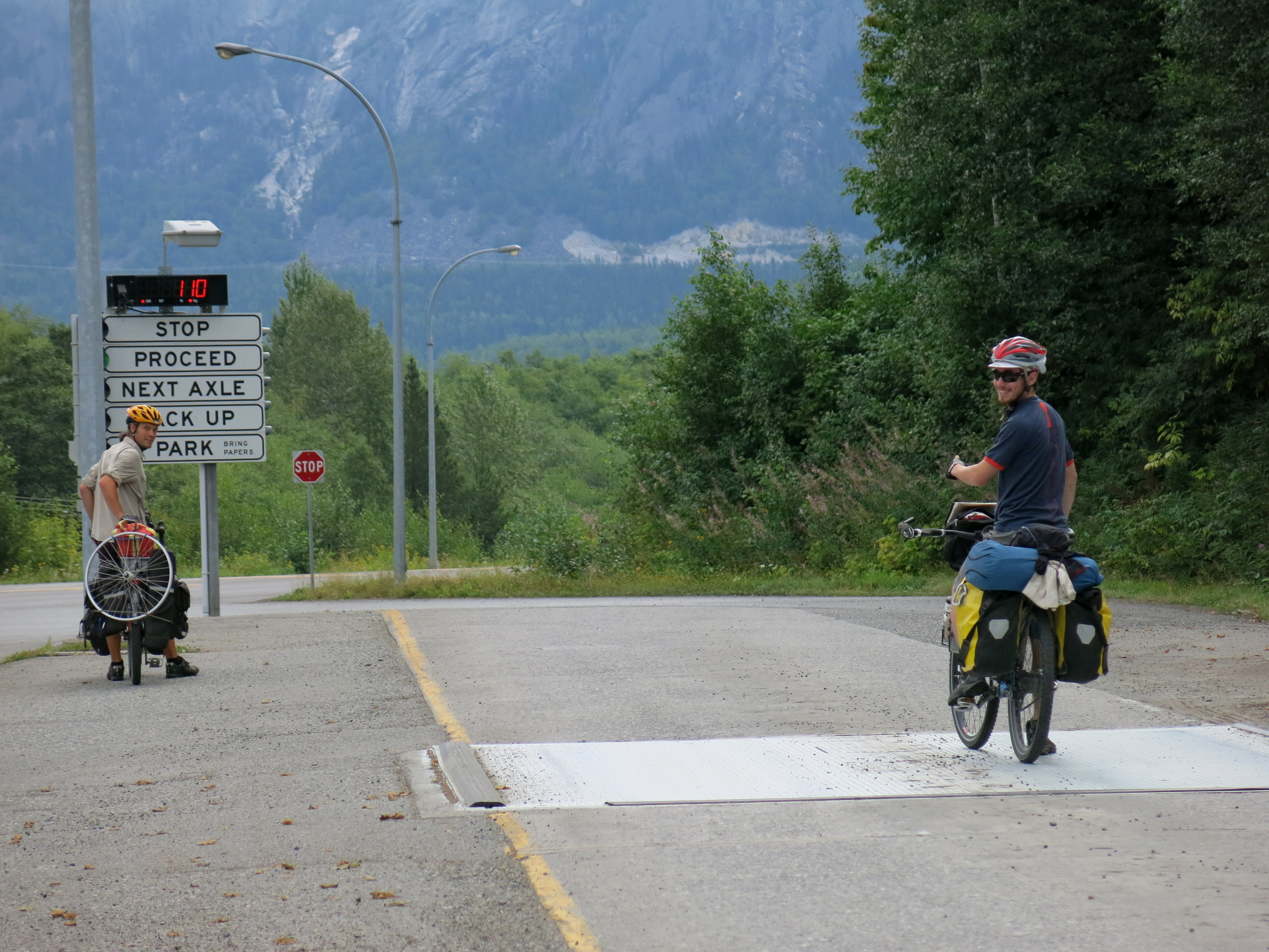
Back in the US. I crossed the border south of Yahk, Canada and north of Bonners Ferry, ID. Seemed like a pretty quiet border crossing- only had to wait for 1 car! No problems with re-entering the US this time… hoping for the same the next time I come back.

IMG_4779

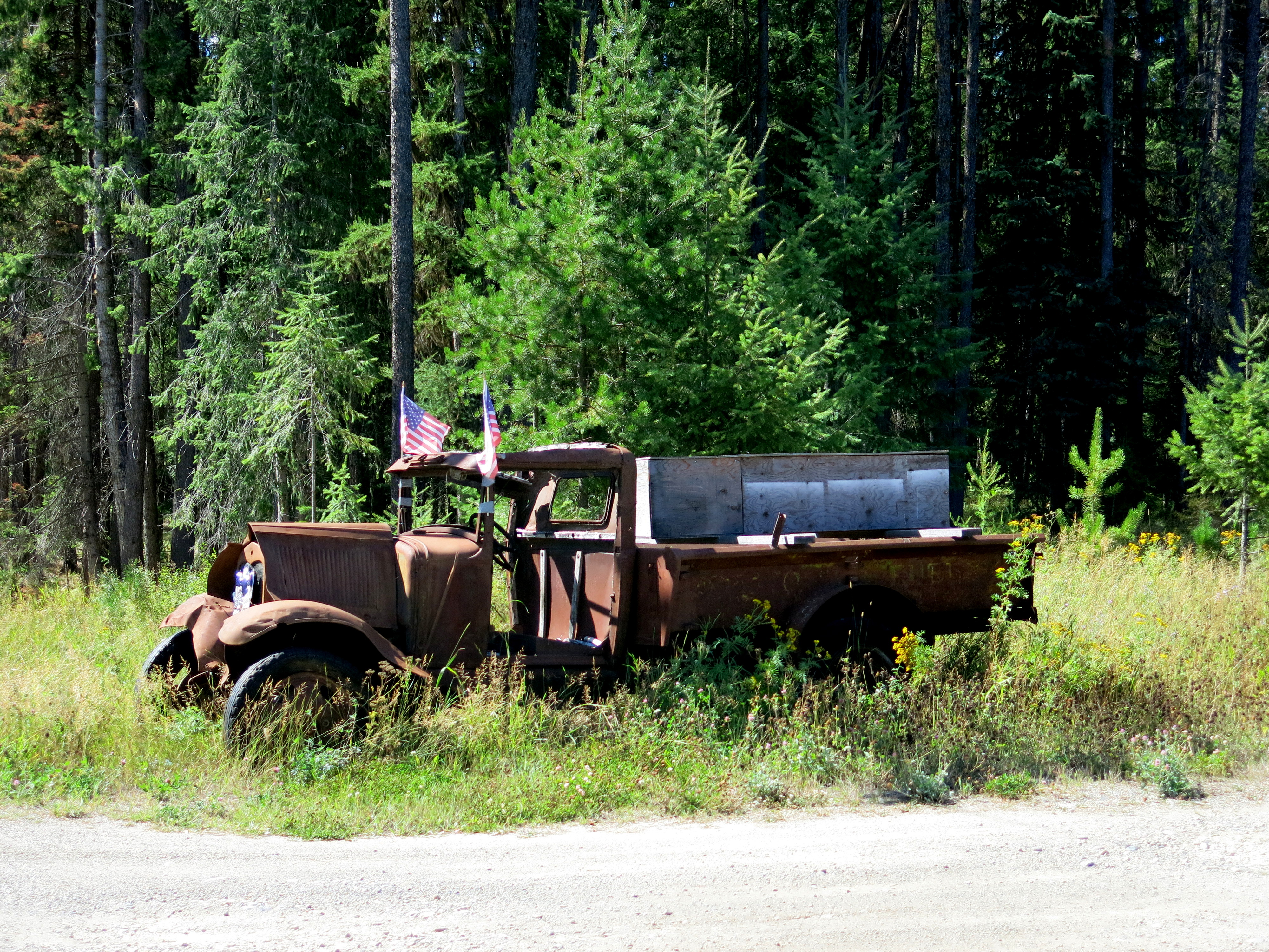
Roadside parking of cars past their prime is the norm, usually complete with one or more American flags. America pride!

IMG_4788

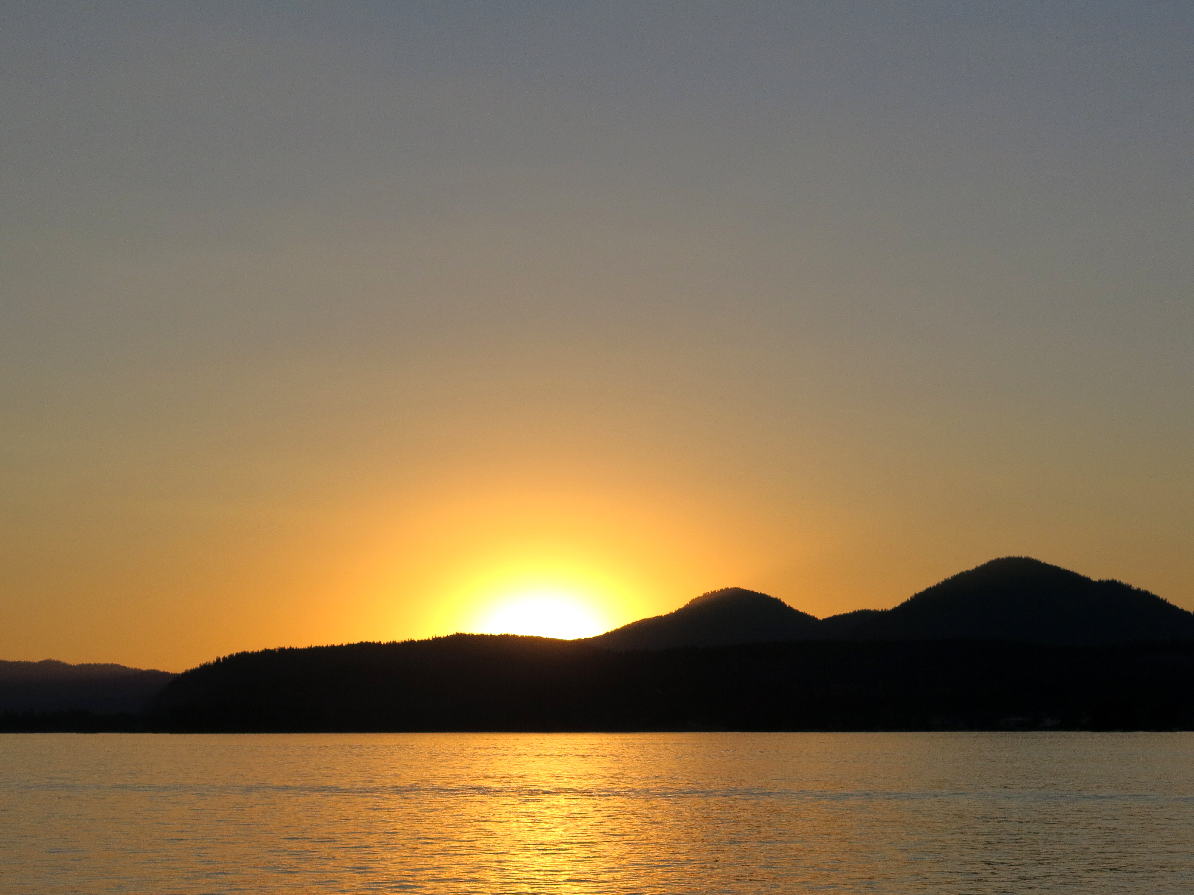
Labor Day sunset in Sandpoint.

IMG_4792

Gladys and me!

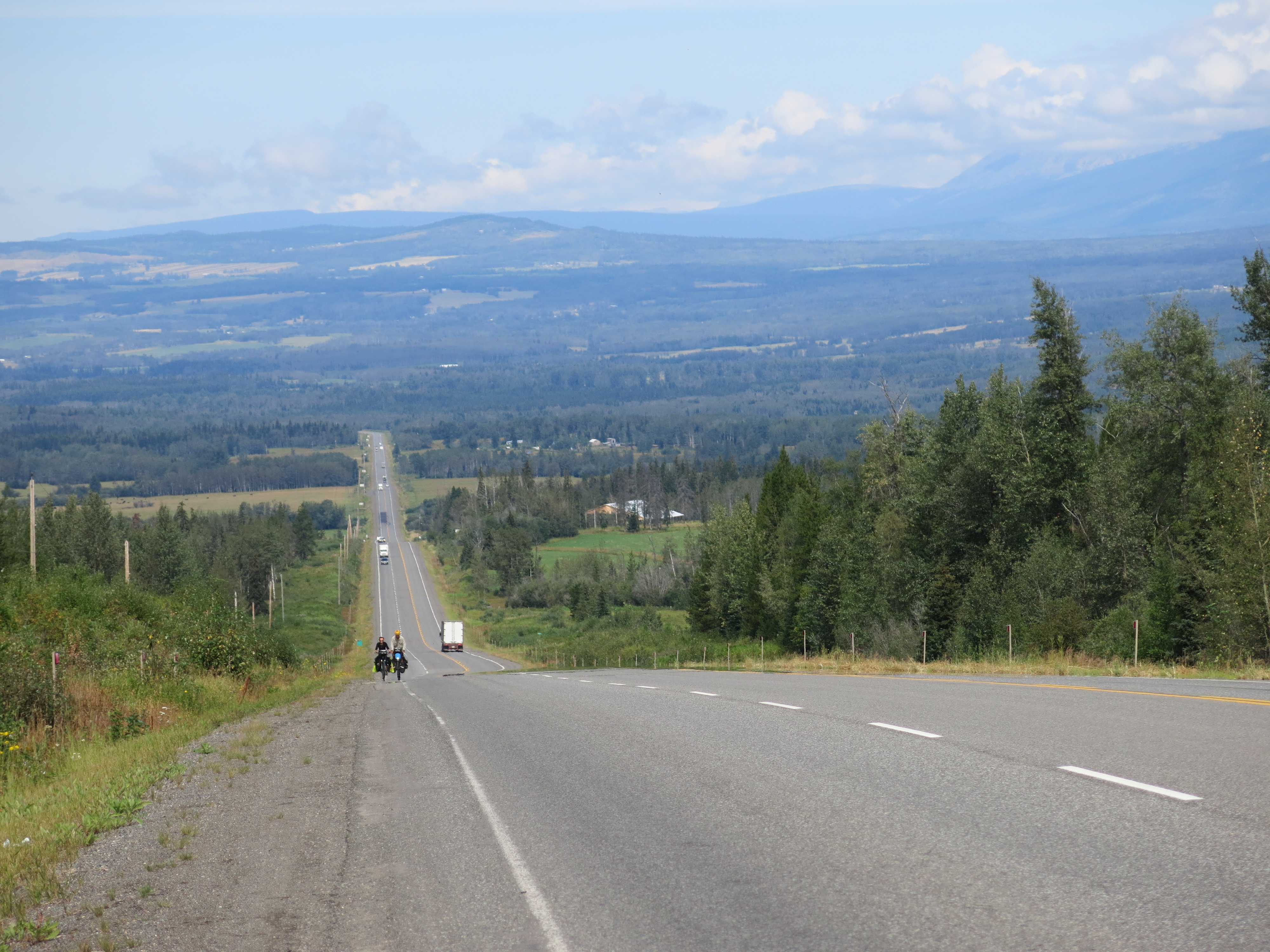
After Sandpoint, I headed east to Kalispell, to meet up with Forest, another friend from school. The route to Kalispell was a very fun ride. First headed east on Rt 200, a quiet two-lane road that wound past several lakes. Every couple of miles there was a pull-off with informational plaques about the lake, about the wildlife, how the land was shaped by glacier movement, etc. Slightly more scenic than the road to Sandpoint from the border. After Thomson Falls, MT, I turned off the pavement and headed north on the forest service roads through the National Forest. Seems like these roads are used mainly for logging and fishing/hunting. Was about 50miles of gravel to connect from Rt 200 up to Rt 2, maybe a good preview of the Great Divide route. Stayed in one of the campgrounds off the forest service road for a night, had the whole place to myself. A sign on the information board said the campground is only maintained until Sept 21, good reminder to keep heading south.

IMG_4793

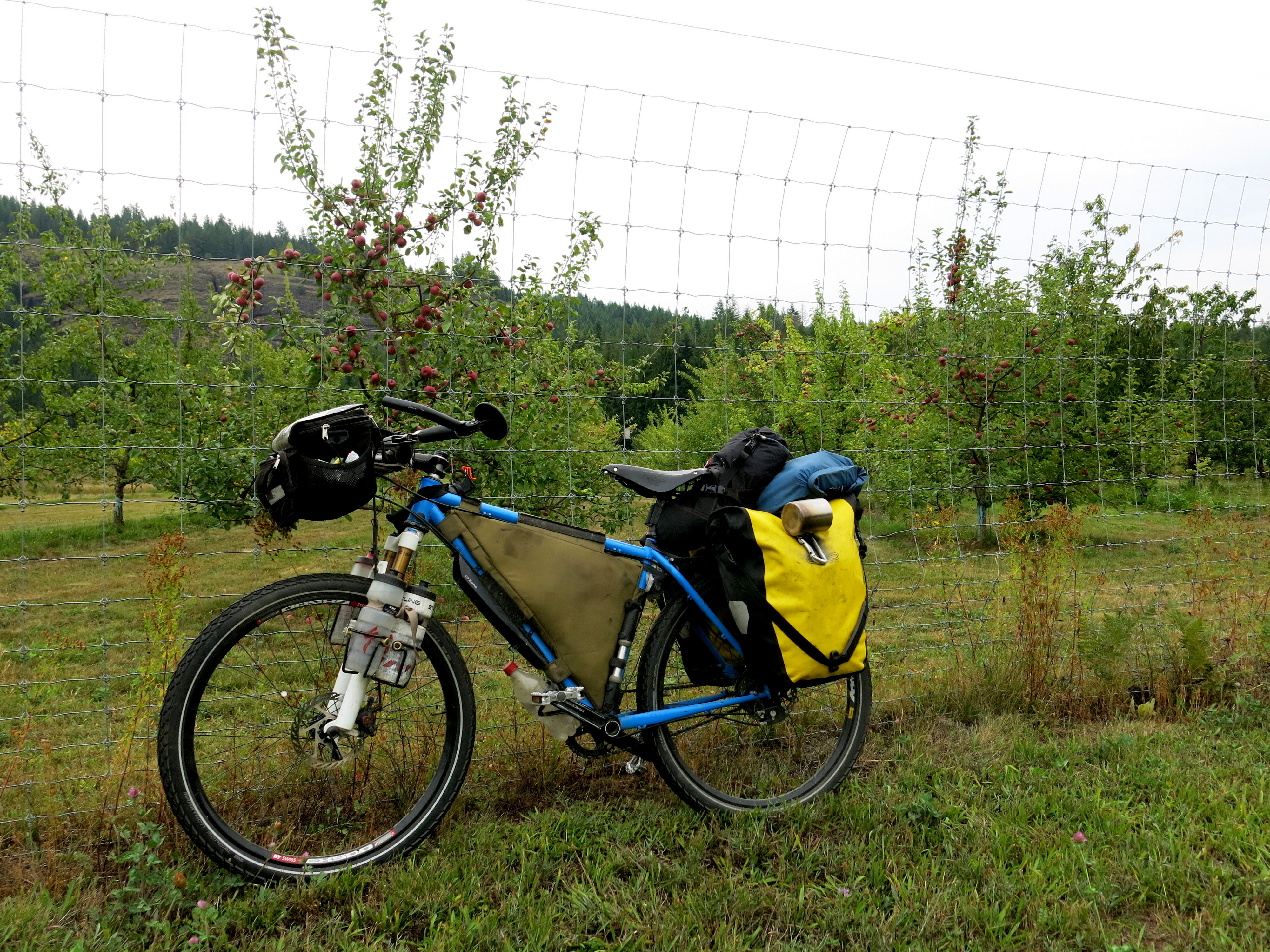
After crossing into Montana, started seeing more and more apple trees, some in orchards, some just by the side of the road. Great to start having other fresh fruit than just the berries of the far north.

IMG_4801

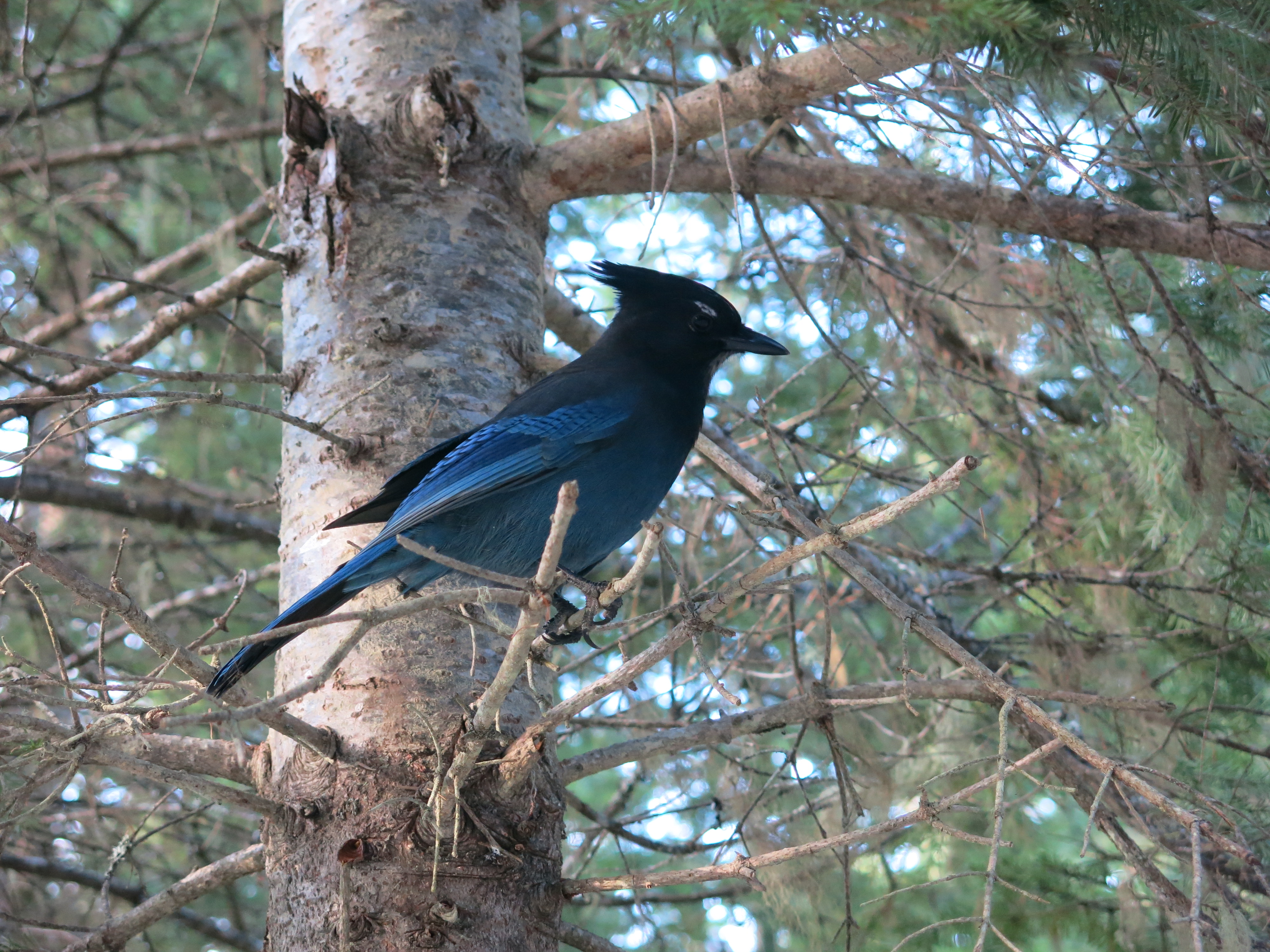
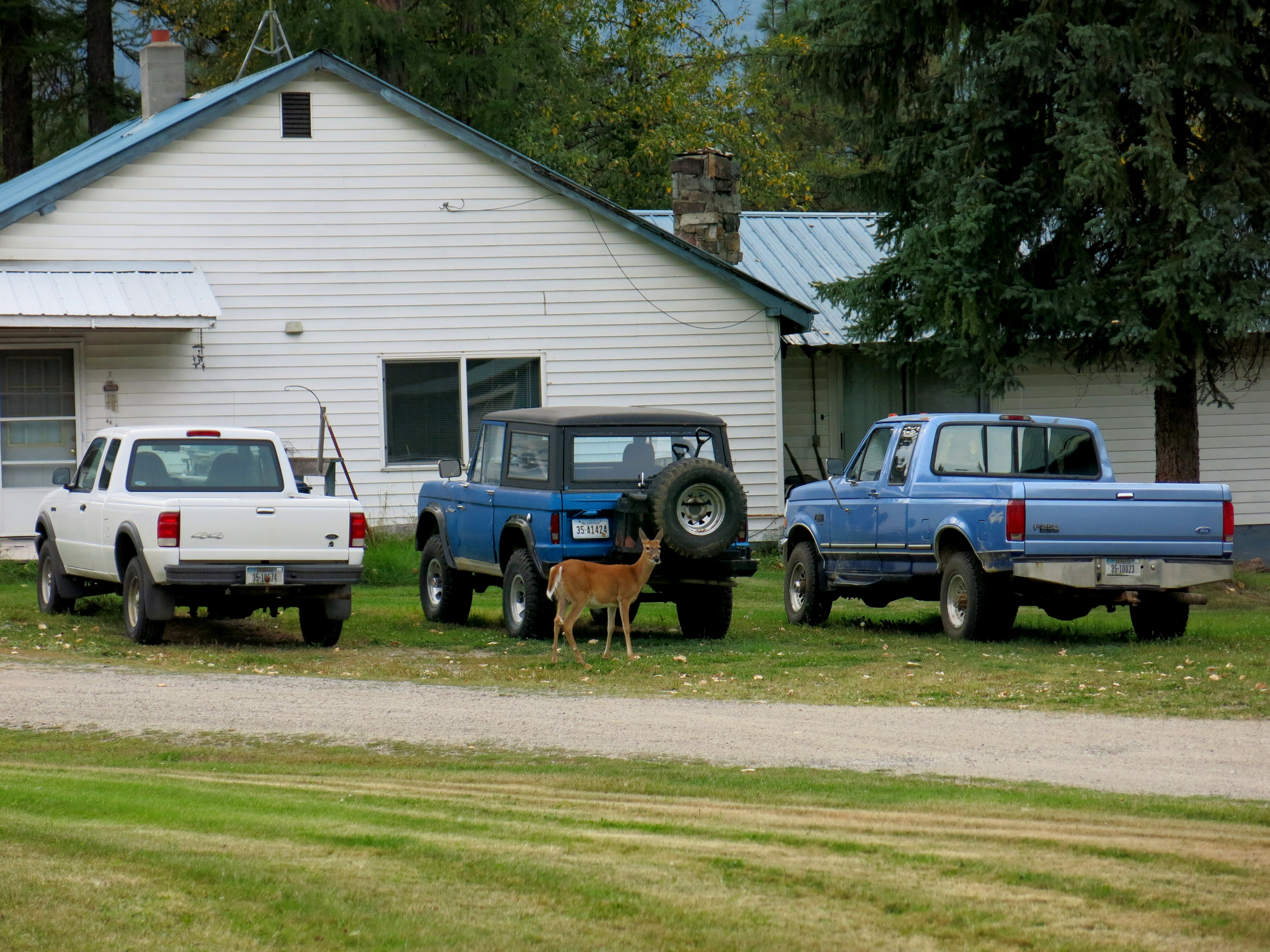
Also everywhere in Montana: deer. Forest says hunting season starts sometime this week, hopefully some of these guys get a little more skittish before then.

IMG_4817

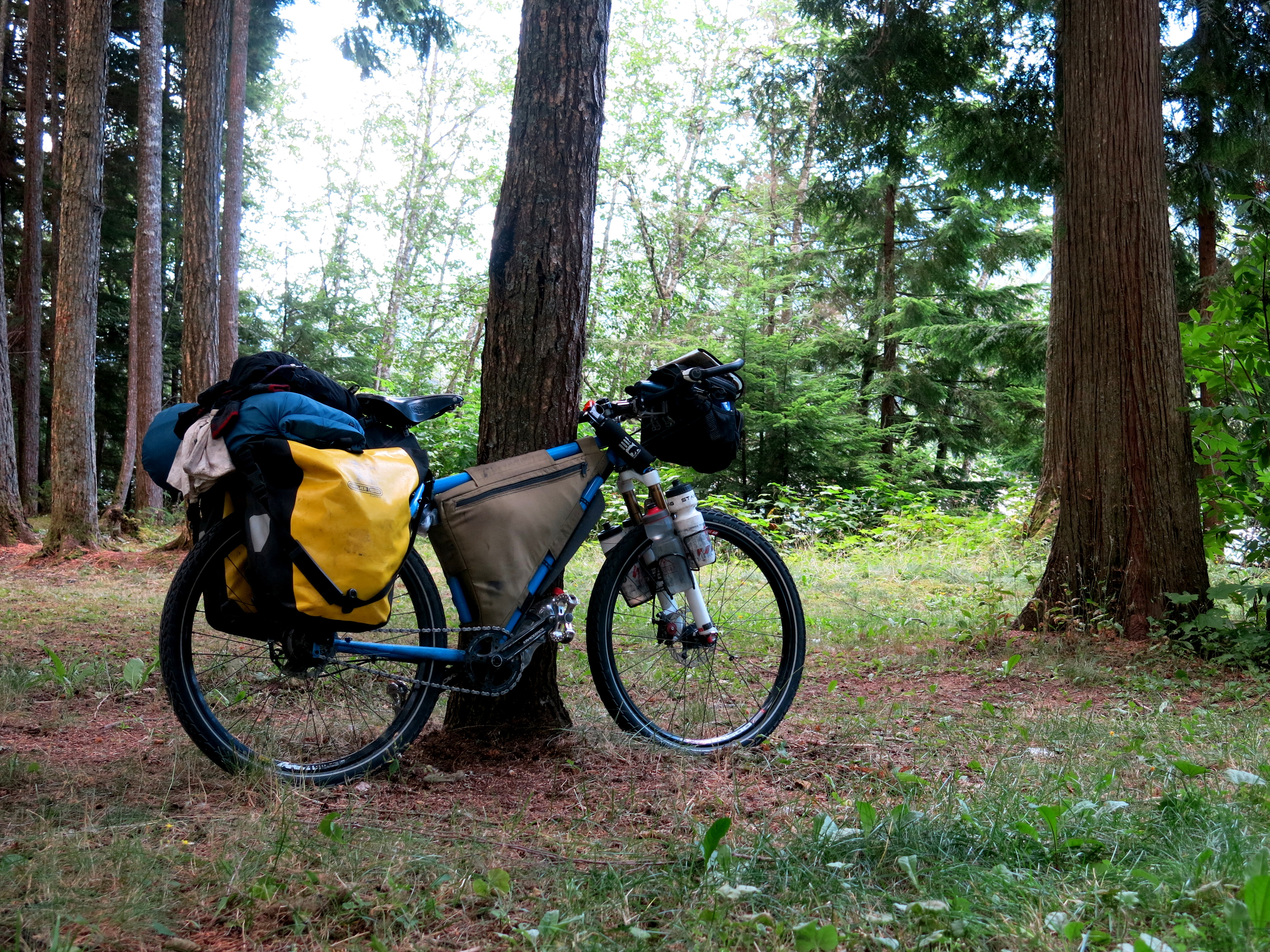
Riding on a forest service road: blissfully quiet, though the gravel and some of the ruts mean it’s time to turn the front suspension back on again.

IMG_4819

Oncoming traffic, Montana style.  Only roadblock of the afternoon.


IMG_4821

Hay farms are everywhere up here.

IMG_4822

The last 10-15 miles into Kalispell were on a great bike path. Road recap: quiet paved country roads, gravel USFS roads, short paved highway stint, then bike path.  Hard combo to beat.

Been resting and hanging out in Kalispell for the last few days, heading out tomorrow south to Missoula then on to Jackson. Finally getting on the Divide next week is going to be super exciting, especially after such a good rest in Kalispell (I slept in a bed for the first time in two months!). Huge shoutout to all of the Nelson family for welcoming me- it was great to meet everyone and a ton of fun to see all the gardens. Kalispell definitely a fun town.

The Icefields Parkway, then back to the USA.

The Canada portion of the ride is complete, which means I’m back in the US, and solo once again. Just before the border, Marc and Noemie and I split, as my route takes me down into Sandpoint, Idaho to visit a friend from school and they’re dropping directly into Montana to ride some roads then head south. But to get this far, we’ve ridden through Alberta on the Icefields Parkway, billed as one of the most scenic drives in the world. It is scenic, running through valleys between the Rocky Mountains, and its high elevation means that glaciers and glacier lakes are visible everywhere, sometimes right beside the road, other times only a 10min hike off the pavement. For the ride down the parkway, we were also joined by Jordy, a Dutch cyclist riding from Whitehorse (back up in the Yukon) down to San Francisco.

Overall, the Parkway was pretty relaxed cycling. Heading south, the road climbs almost the entire way to the first pass to the Columbia Icefields. But it’s a very gradual climb until you reach the pass itself, then it’s a steep ascent to the top. Riding down the other side should be a nice descent, but instead we hit a headwind that slowed us almost to the speeds we were climbing at. Luckily, there’s only a short distance after the pass to the Icefields Center, a visitor center/tourist trap of tours onto the Icefields, a huge glacier field right beside the road. The center is a nice place to rest and eat lunch after the pass. We took three days to ride the Parkway; the first was planned to be a rest morning in Jasper, then a short 35km ride to the first campground along the road. This campground ended up being closed due to bear activity, so we ended up riding another 15km to Honeymoon Lake Campground. Not too far, but the Alberta weather kept us diving off the road every 30min as a 5min wind/rain storm swept up and over us. These rapidly changing weather patterns kept up the whole way down the Parkway, so rain gear was always kept readily available. Our second day on the Parkway was to tackle that first pass, ending at Rampart Creek Campground, which incidentally had the first mosquitoes we’ve seen since the Yukon. Luckily not nearly as bad as up north. Our third day we rode up and over the second pass of the Parkway, up to Bow Summit and Peyto Lake, a beautiful glacier lake. The third day we got rained on pretty steadily, though fortunately the pass is not nearly as steep as the first, and as soon as we got to the top, the sun came out so we at least saw the lake in nice weather. Once back on the bikes after the lake, a chilling descent sent us into a small lodge seeking warm coffee and tea. The end of day 3 put us in Lake Louise, where we planned to rest and take a day off to go on a small hike up to a teahouse in the mountains.

Lake Louise is another glacier lake, forming the southern end of the Parkway. There’s a resort town built around the tourism generated by the lake, as well as a monstrously ugly hotel right at the base of the lake. We stayed at the campground (a fancy one, with oh so hot showers) and did a short day-hike around the lake. At the end of two of the five or so possible hikes around the lake, teahouses were built in the 1930s to support climbing expeditions into the surrounding mountains. There’s no electricity at the teahouses, and all supplies are trekked up or down the paths. They’re a pleasant place to rest from the sometimes steep ascent.

Post Lake Louise, Jordy headed into BC towards Vancouver, and Marc, Noemie, and I went south and then west into the Kootenay National Park towards Radium Hot Springs. BC welcomed us back with warm sun immediately upon crossing the BC/Alberta border, which, partnered with the oh so relaxing water at the hot springs was all we needed to convince us that BC is definitely more our favorite province than Alberta. The hot springs at Radium weren’t all that crowded, and the water is pumped into swimming pools that make lounging about oh so easy. After spending a morning soaking in the hot springs, we left town only to be greeted by a fierce headwind, which continued into the next day until we reached Cranbrook, which apparently in native language means “where the wind blows in your face”. We can attest to the validity of this translation. In Cranbrook Marc and Noemie and I went our separate ways, after a farewell Coke float/mudball (spreading that Stanford Cycling gospel) party and a final grocery run.

Battery’s running out and Picasa is acting up, so I’ll post more and upload some photos in a few days. Expecting to have better access to internet here in the US than Canada.