
Deadhorse, AK to Fairbanks, AK.
First 500 miles in the bag. Ended up making much better time than expected, thanks to a lot of unexpected little motivations along the way. These included: a) trying to keep up with Wataru, a Japanese cyclist going around the world, who’s been riding for 1 year 7 months and was thus in much better shape than I was; b) worrying that I had underestimated how much fuel my stove would need and thus not having enough for 10 days; c) decent headwinds (or at least lack of tailwinds) most days; d) having the sun shining down almost every single day and discovering that the Dalton Highway is in pretty good condition when the sun is shining. I would guess about 30-40% of the Dalton is paved, and the rest is fairly hardpacked dirt. Knobby tires and suspension not necessary, though the suspension definitely helped smooth out the ride.

Wataru and all of our gear upon arriving in Deadhorse. Photo taken at midnight.
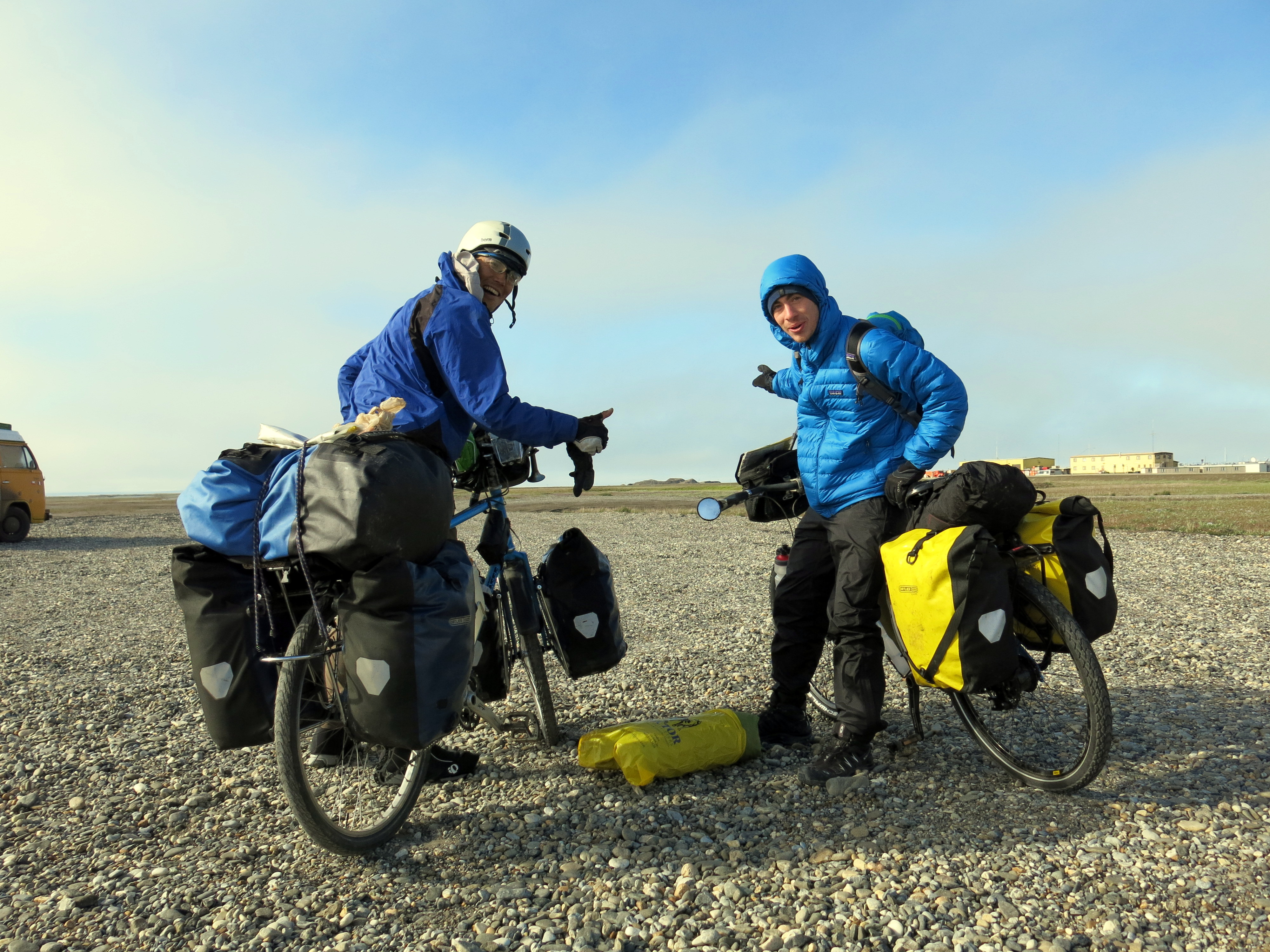
The next morning. Loaded up and ready to head south. Deadhorse is freezing! All the winds coming off the seas blow right over the town (town = very small collection of buildings), and since nothing grows on the surrounding tundra there’s nothing to shield from the wind. So we bundled up. The last few miles north from here to the Arctic Ocean are on a private road controlled by BP; no outside traffic allowed. This was the last time I saw Wataru…

Fairbanks is only a few miles away…
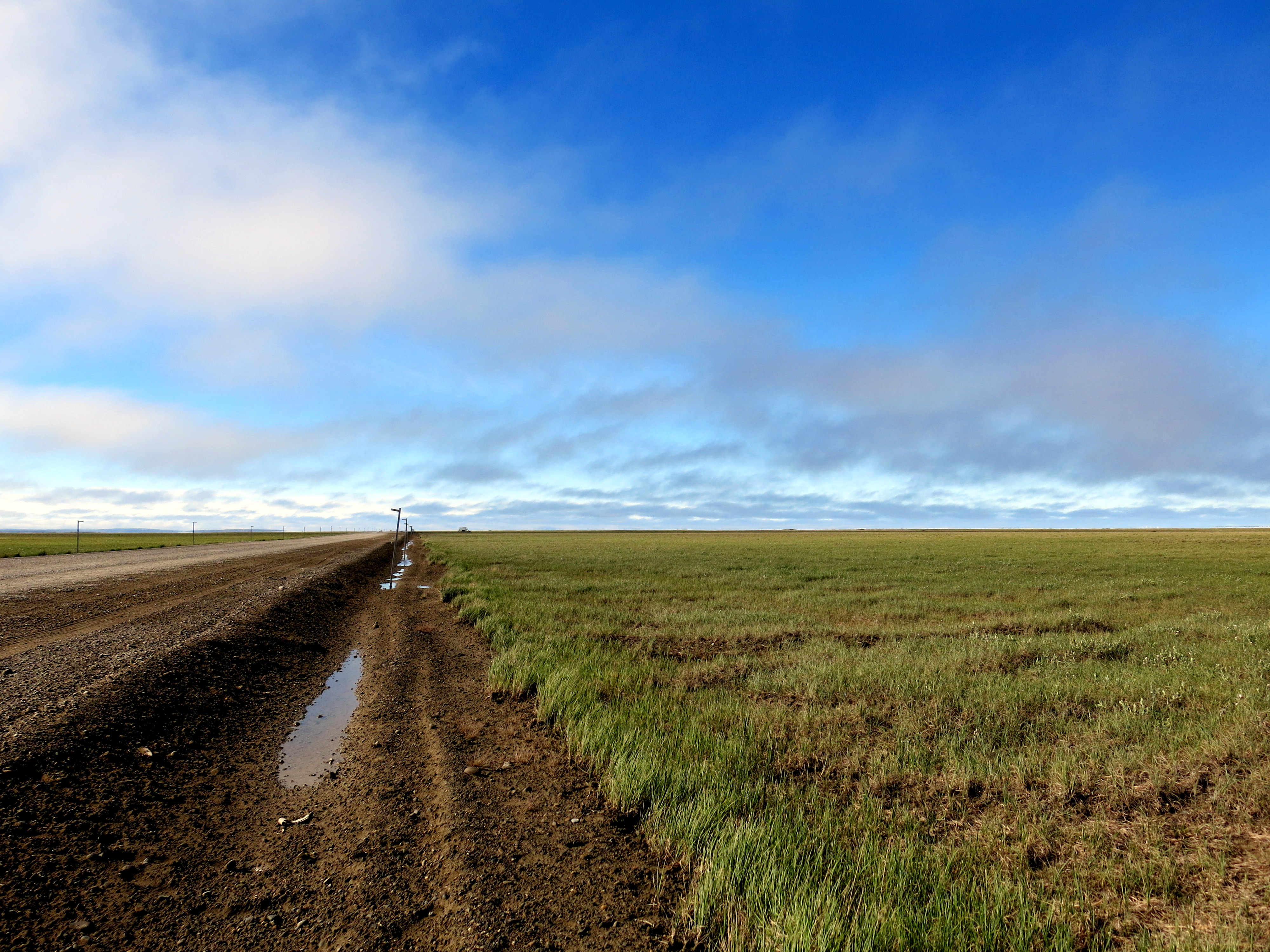
The Actic tundra. The land looks like this for the first 150 miles or so south, until you cross over the Brooks Range. All around grass covers the land, and without weeds, it looks like perfect ground to plant crops on. At least it does until you actually step onto the grass, then you realize it’s actually a marshland. There’s a layer of permafrost a few feet under the surface, which, even though the tundra is a desert, keeps all the water that does fall on top of the surface. The pump stations that keep the oil flowing through the pipeline have to be built on refrigerated bases to keep from melting the permafrost underneath them.
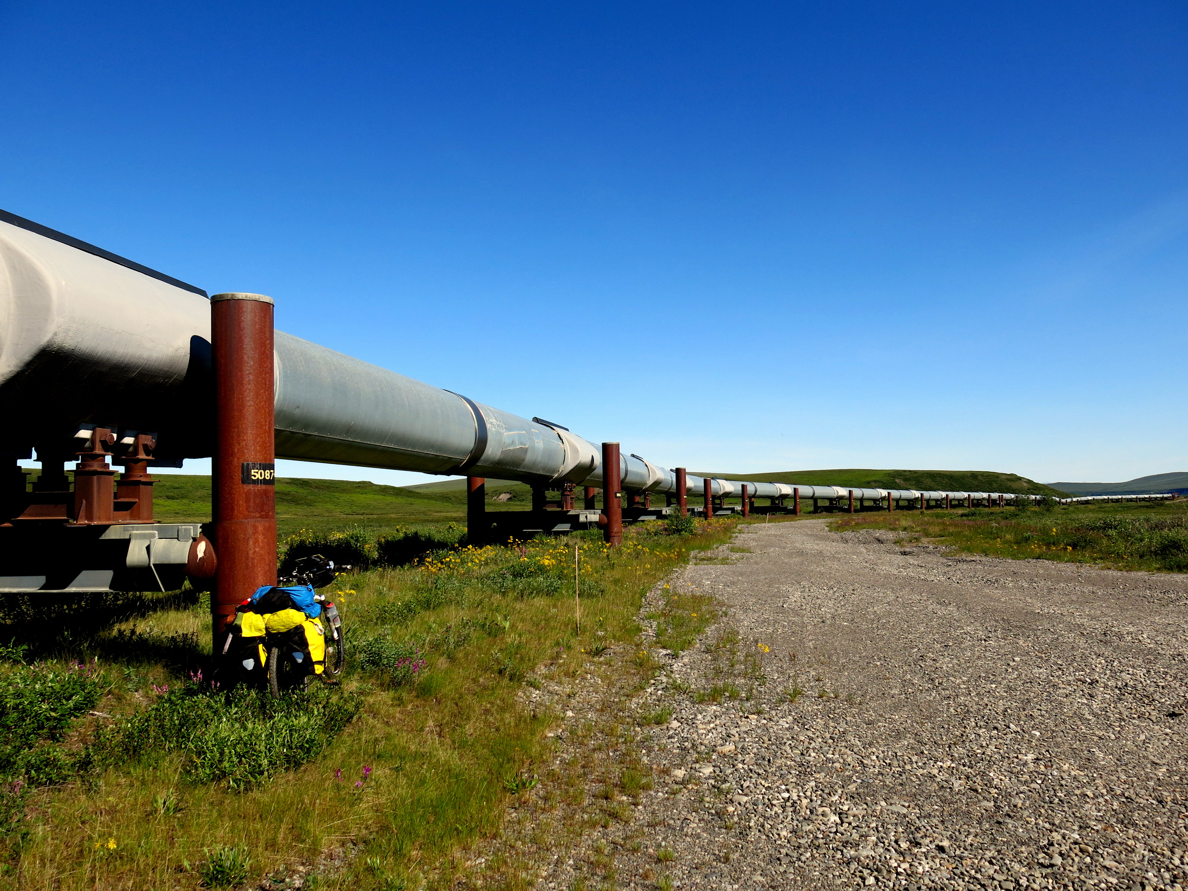
The Alyeska pipeline, cutting across Alaska from Prudhoe Bay in the north to the port of Valdez in the south. This beast is the whole reason the Dalton Highway exists, and it rises out of the ground next to the road almost the whole way. Sometimes it dives into the ground when the road crests a hill, but it’s always present. Respect to the engineers who designed it- apparently the pipeline is currently 10 years past its design life and still going strong.
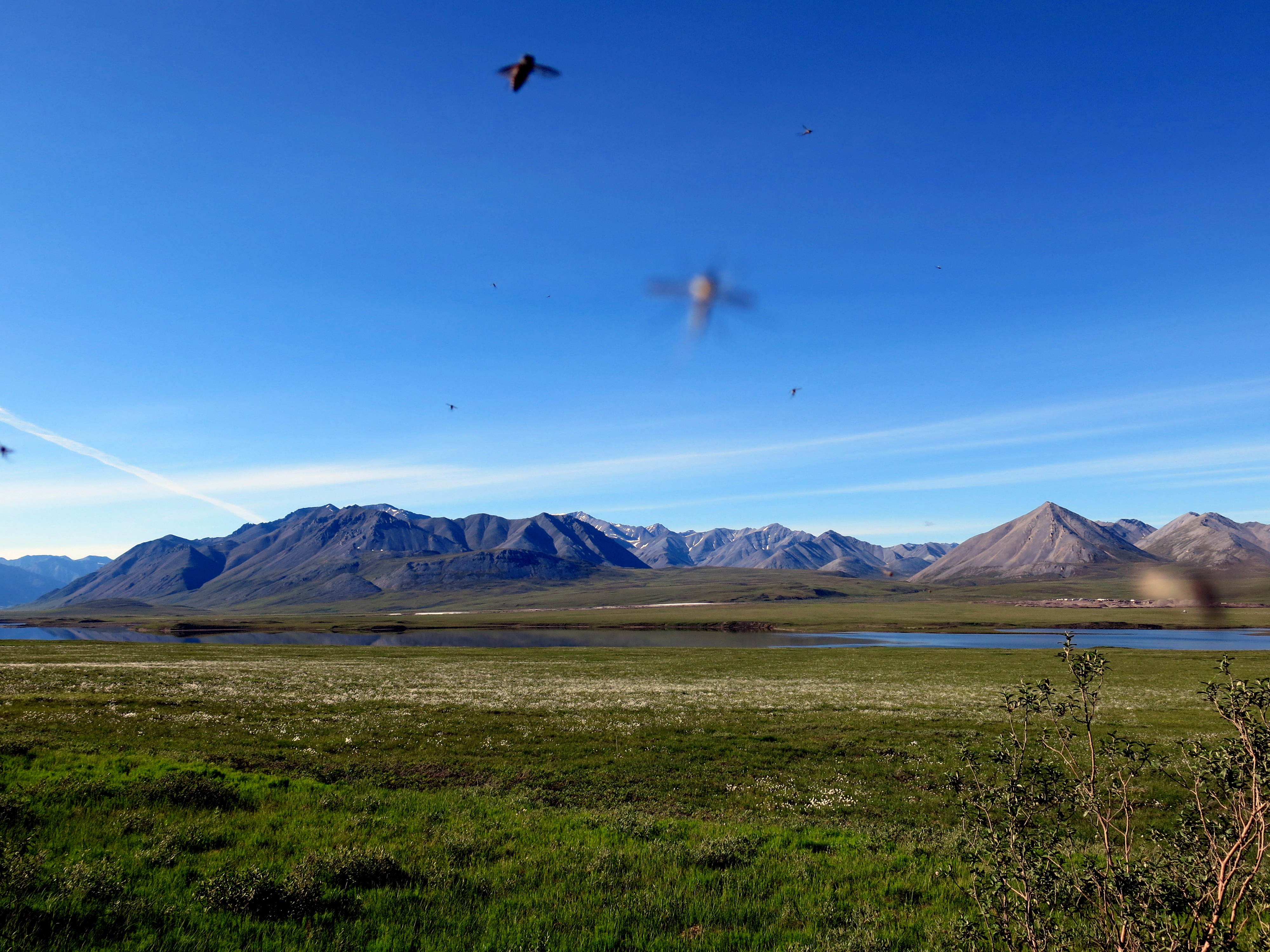
Alaskan mosquitoes are killers. They swarm if there’s no wind around. Their bodies have some kind of natural antifreeze to survive the -40, -60 degree winters. Supposedly the ones in the Arctic are the worse; we’ll see. These little buggers are responsible for driving the herds of caribou into the cold, high mountains all year. Don’t attempt to bike/camp up here without at least mosquito netting for your face.

Camping spots were always easy to find along the Highway. There are some designated spots with drop toilets and bear-proof trashcans at 60/70/80 mile distances, or there are plenty of construction and pipeline access roads to pull off on and set up camp. I had no problems with bears, only saw a few tracks, though some people driving I talked to said a black bear had crossed the road in front of them that morning.

Atigun Pass in the Brooks Mountain Range is the tallest obstacle in the road, though really it’s not very steep, just a little longer of a climb. Climbing over Beaver Slide further south was much more difficult, just because it was much steeper and was a mess of loose gravel when I got to it. Might be less of an obstacle heading south-to-north, but a lot of the road south of the Brooks mountains is a lot of rolling hills, so hard to say which direction is more difficult.
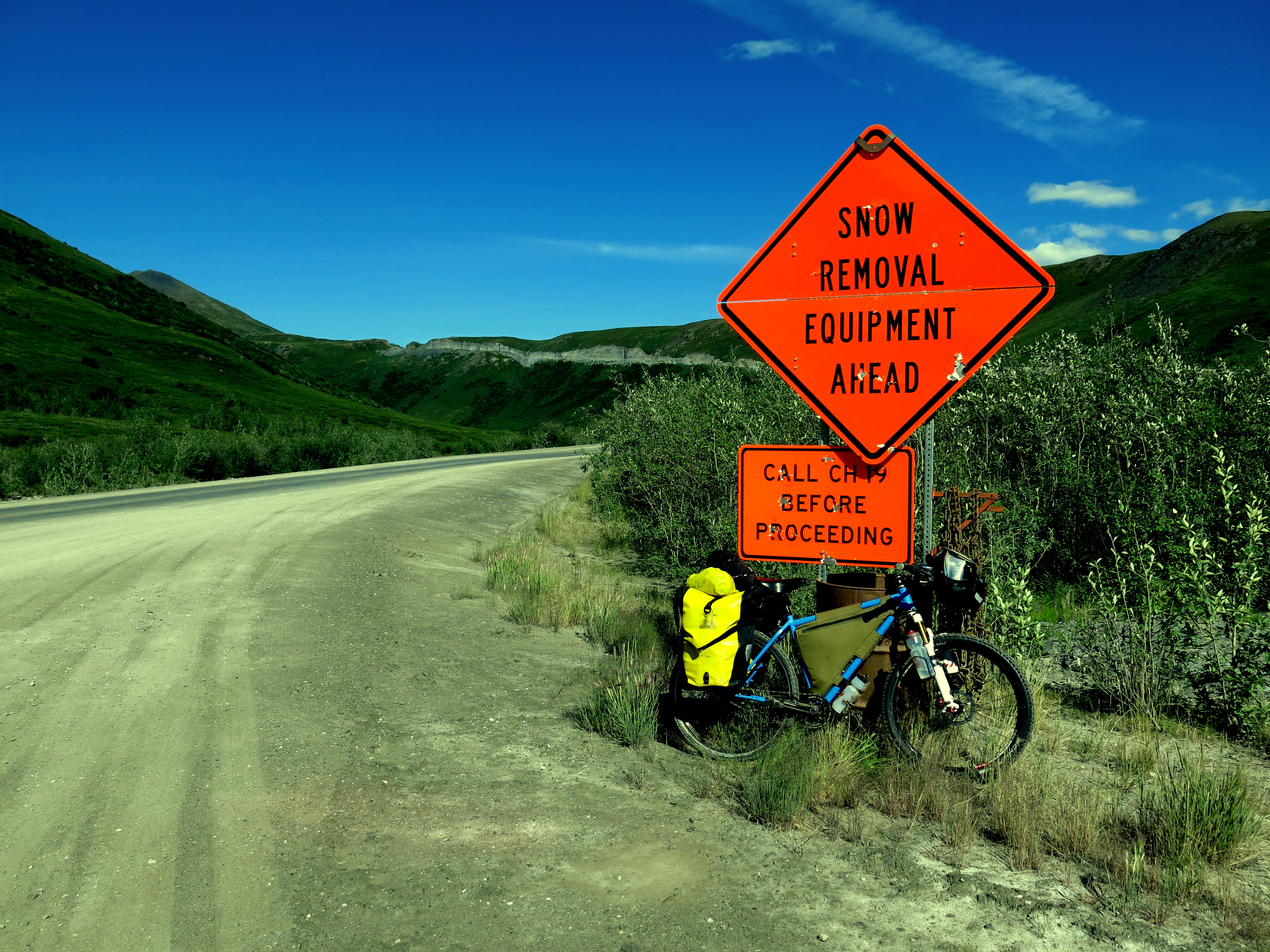
Luckily I encountered no snow along the road. The truckers, of which there are many, were always very courteous, slowing down and giving plenty of room when passing to avoid spraying gravel everywhere.

The farthest north spruce tree is just on the southern side of Atigun Pass. Unfortunately, some vandals took a chainsaw to it a couple of years ago and killed it. But Mother Nature recovers, and due to the Earth warming a few trees have started growing a tiny bit north, so eventually this sign will get moved. Due to the extremely short summer up here, all vegetation takes about 4-8 times as long to grow as their southern counterparts.
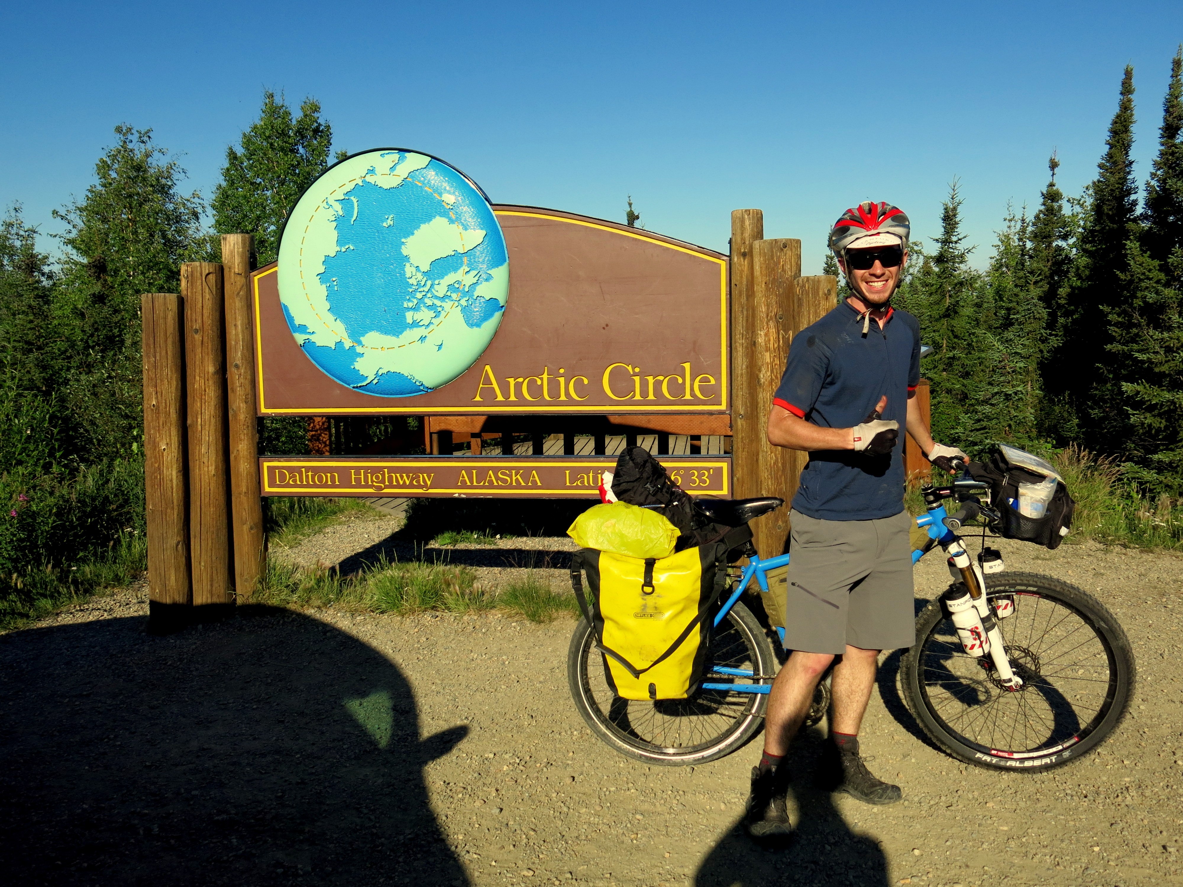
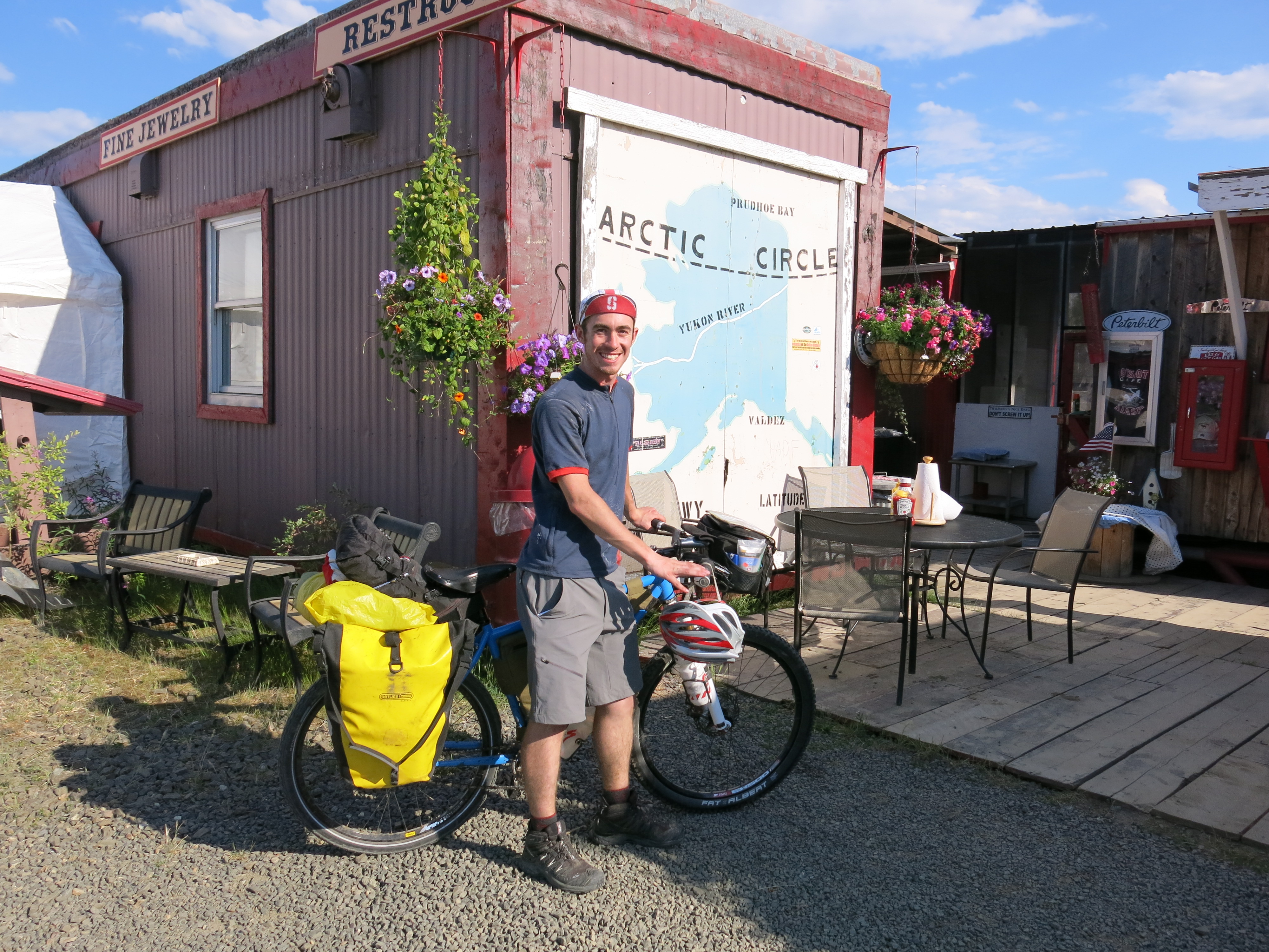
Crossing over the Arctic Circle, where in the summertime the sun circles in the sky all day long. This made pitching the tent at night a logistical headache, as there was no rhythm everyday as to where the sun would be the next morning, and thus no good way to avoid the sun shining right on your face in the middle of the night.
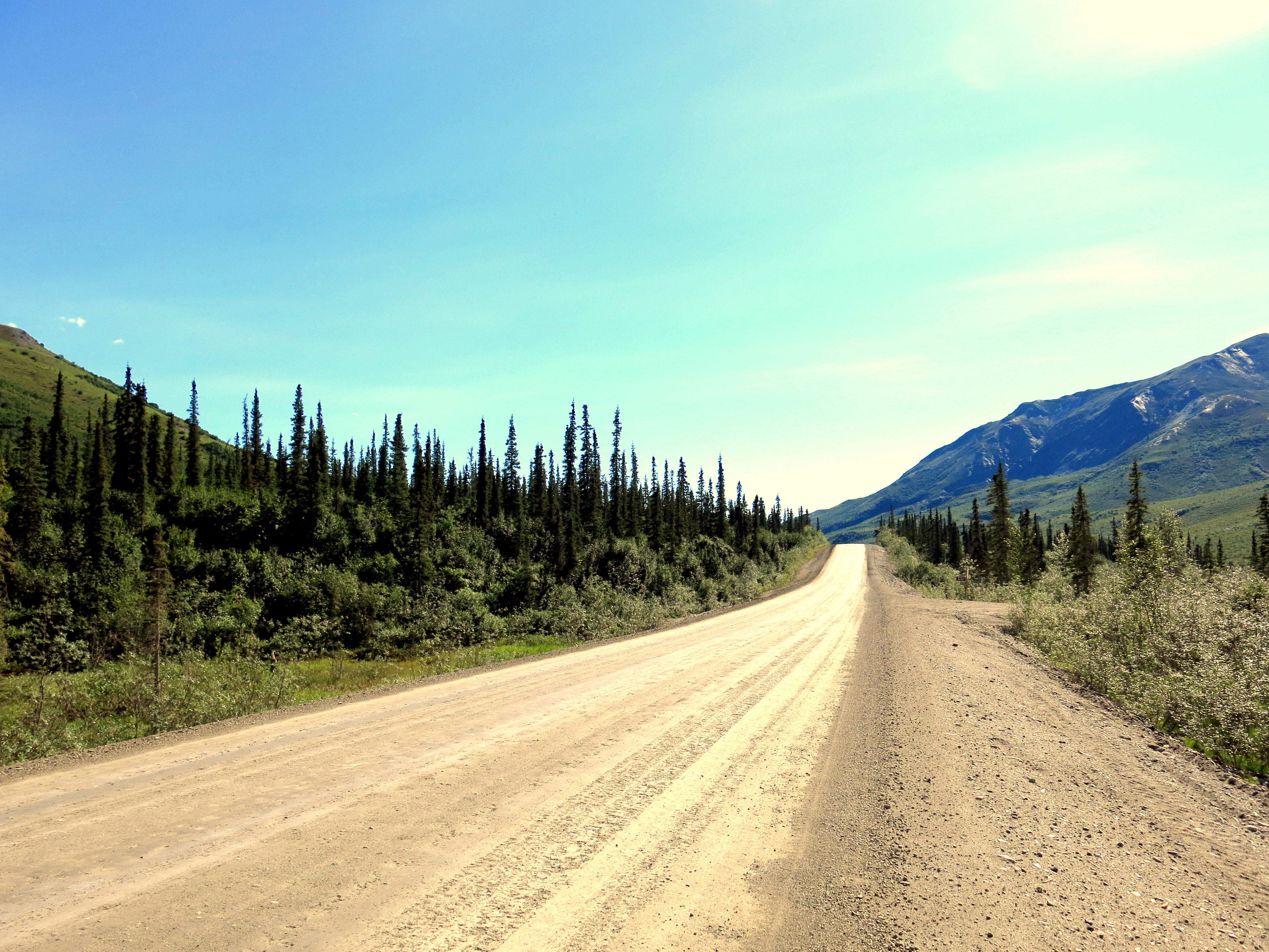
The section of the road just south of the mountains was one of my favorites. Hardpacked gravel, spruce trees everywhere, and usually a strong river flowing on one side of the road; beautiful.
The Hotspot Cafe at Five Mile is one of the legendary (few) eating places along the Dalton. Not knowing what time they closed, I was determined to get here day 5. The place was started not long after the Dalton Highway was built, as according to legend two pretty young ladies decided to come to Alaska to make their fortune. They opened up a shack selling hamburgers to the truckers, and business boomed. One of the women ended up marrying a trucker and moving to CA; the other, Teresa, still runs the cafe with her staff and still serves quite a tasty burger. I was sure I would catch up to Wataru here, so I pushed all day. Unfortunately, he had just left when I got there. After my burger, I decided I had enough of cycling for the day (72 miles in what turned out to be 95deg heat) and called it a night.
Further south, there were wild blueberries growing along the side of the road. They were a tasty treat, all the more so because I didn’t pack much fruit for this leg of the trip.

For me, this was farewell to the Dalton Highway. I made it! Now only 80 miles left on the (paved) Elliot Highway to Fairbanks.
And hence, now I’m back in Fairbanks. Have been giving my knees a rest for the past two days, and going through email and gear tweaks after a much needed shower and laundry. Heading on south and east tomorrow towards Denali National Park and then the Canadian border, should be in Canada in about a week. Huge shoutout and thanks to Doug (and Kathy for the connection) at the Univ. of Fairbanks for hosting me these past few days and has been way supportive and generous. Wow. Long post for (at least what seems like) a long way traveled. Hopefully will be able to update more frequently in the future.
Never quite managed to catch Wataru again after Deadhorse, everyone I asked along the Dalton always said he was 1-2hrs/10-20mile ahead of me. But we have similar plans for at least the first portion of Canada and are both headed towards South America, so will probably coincide again somewhere down the line.

Sam,
Glad we spent time together before you embarked on your trip. Keep up the posts as we are all anticipating interesting stories which might end up in a best seller one day. Best, Uncle Joel
Sam – I love reading this! Please update whenever you can, and the pictures are awesome!!!!!!
AHHH!!! this sounds UHHHMAZING!!! I still can’t believe it. keep it up 😀
Hey Sam- well done! Keep up the good work and let me know what you want me to send you! -Chris
Don’t worry, man. You’ve got mad heart, and that’s all it’ll take to beat the Japanese.
More seriously–wow! What an adventure. I wish you all the best, my friend.
Sam, sounds like you’re living the dream!! Loving the updates, and hope you continue to have a great time. Keep on keepin’ on!